At the Western Edge of Europe (1): The Cliffs of Moher

Burren Quin sign

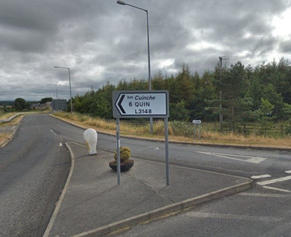
Between Shannon Airport and the village of Liscannor, a roadside sign points to a trace of my Irish ancestry in the village of Quin.

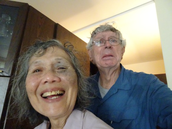
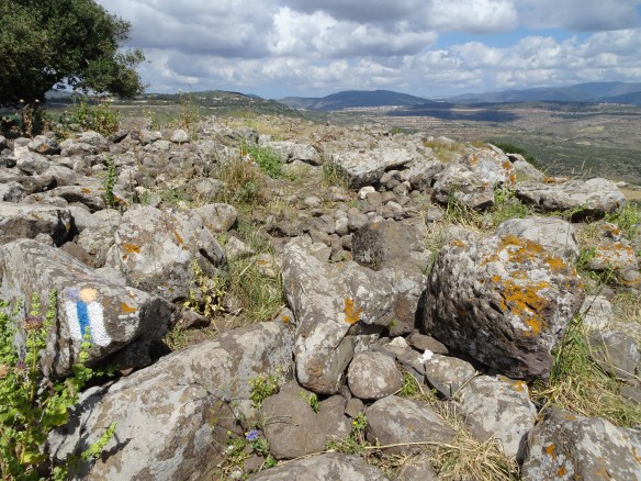
It was my first visit to Ireland. Emmy and I went by taxi from Shannon Airport to the township Liscannor on the Atlantic coast about one hour away. We passed roadside signs pointing to the village of Quin. A strange feeling came over me. It wasn’t deja vue exactly, but rather a vague feeling of familiarity. Perhaps this is where my ancestors came from. I don’t know much about them except that they fled Ireland around 1870, initially settling in the lowlands of Scotland, then migrating to Canada and later to New Zealand where I was born. Quinn – with its variants Quin, O’Quinn, O’Coinn, Cuain, Cuinche and others – is a common Irish name found right across the island. It is especially common in County Clare where we saw it on several signs as we walked the Burren Way up the west coast. Unexpectedly, I found myself walking on what might have been my family’s ancient home ground.

Burren Quinn Abbey

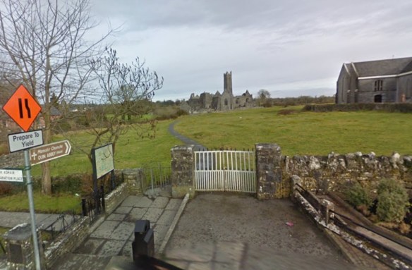
Quin Abbey in County Clare. This tumbledown ruin and me… we have a lot in common. (Google Earth image)

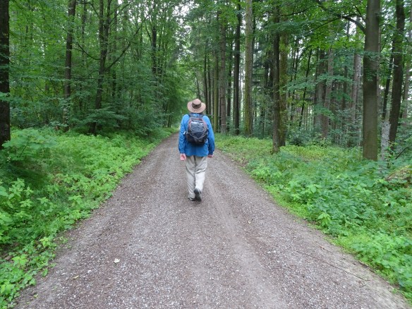
On the morning of July 22nd, with a blustery wind slapping at us from the chopped-up waters of the Atlantic Ocean, we shouldered our backpacks and headed out of Liscannor towards the southern end of the famous Cliffs of Moher. We were on a track called The Burren Way. Our destination for the day was the hamlet of Doolin, about twenty kilometres to the north. We walked into green pasturelands, criss-crossed by rough stone walls, that sloped down to a grey sea. Isolated white cottages crouched in the grass with beige-coated cows dotted around them. There were no trees, the roads were empty, and the homesteads too seemed deserted. We walked alone.

dsc01066.jpg

The famous, windswept Cliffs of Moher.

DSC01062

Emmy braces herself against the Atlantic wind with O’Brien’s Tower in the background.

dsc01067.jpg

Rough slate walls helped protect us at the edge of the cliff.

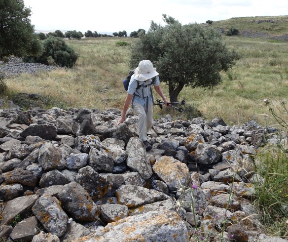
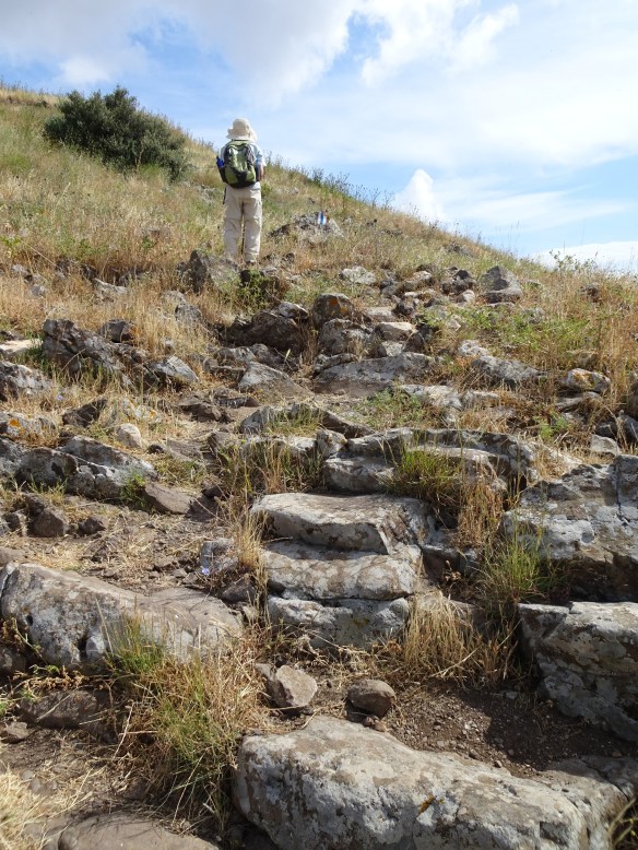
Our walking poles came out early. We levered our way up a long, gravelly asphalt road towards a ruined stone tower – O’Brien’s Tower – standing high above the sea. From there, looking north we saw a series of steep dark headlands diving almost vertically into the sea. The path narrowed and veered towards the edge of the cliff. Far below, the white breakers of the Atlantic boiled against the rocky teeth of the cliff base. In some places big slabs of slate had been placed like a low wall between the path and the edge of the cliff. We had to wobble over at least half-a-dozen stone stiles.

DSC01059

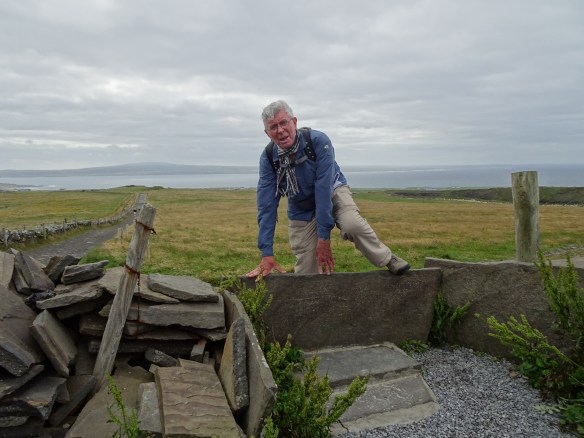
Stone stiles… my technique was to sprint up to the stile, leap high into the air, and soar over it in one youthful bound (as illustrated in this photo).

We met a few walkers coming south, and as we crept north more and more of them appeared. About twelve kilometres from our start-point in Liscannor – a bit over halfway through our walk to Doolin – the crowds thickened. Again and again we had to press ourselves against the side of the path to let them past. The path widened to accommodate a horde of day-trippers: howling toddlers in pushchairs, fat Americans wheezing and dipping into bags of potato crisps, teenagers daring one another to take selfies at the cliff’s edge, clusters of Spanish tourists talking among themselves earnestly, intently, rapidly and non-stop as they walked, indifferent to the natural spectacle around them.

dsc01068.jpg

Teenage day-trippers dare one another on the cliff’s edge.

Then, in the distance, we saw where they were coming from: the Cliffs of Moher Visitor Centre (called, I’m sorry to report, “The Visitor Experience”). To keep it unobtrusive, the Irish authorities have hidden it under the flanks of a grassy hill. But the parking area cannot be hidden. Its hundreds of cars and buses glisten like a bright, ugly, constantly mutating melanoma on the green skin of the landscape.

dsc01070.jpg

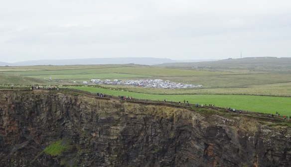
Like a melanoma on the skin of the landscape: the jam-packed parking area at the Cliffs of Moher Visitor Centre. Note the crowds of day-trippers walking the edge of the cliff.

The Cliffs of Moher are one of Ireland’s most popular tourist attractions. They bring in a clutter of mobile phones, baseball caps, over-sized sunglasses, and headphones whispering to the outside world the deafening thumps of music that fill the heads of their users. The cliffs are an interesting natural phenomenon, even spectacular in places, but most visitors scan them quickly, and with a curious indifference, before recording some photos and heading back to the Visitor Centre. The cliffs are a “celebrity location”, famous, above all, for being famous. You go there in order to say “I have been there.”

Travel, they say, broadens the mind. But modern mass tourism seems to do the opposite. It actually narrows the mind. It reduces, and tries to monopolise, options, flexibility and contact with local people. Travellers are whisked from site to site in buses or cars, given pre-digested “information” about each site, allowed photo-ops, then delivered to gift shops. This kind of travel is just another form of consumerism… you collect destinations and take them home in your mobile phone like selfies with sports stars and the autographs of media personalities.

What’s worse, because of tourism’s indifference to the celebrity locations it promotes, it ruthlessly exploits, and ultimately destroys, them. Mass tourism means getting close to the fame of a place – however fleetingly – without bothering yourself with the origins or meaning or authenticity of that fame. Barcelona, Venice, Amsterdam, Jerusalem’s Old City, the Eiffel Tower, the Tower of London, the Colosseum, the Parthenon, the Louvre – hundreds more – have become unbearable ant-hills of people, offering little more than glimpses of history, or greatness, or beauty amid a relentless crush of people, and a litter of souvenir shops and fast food outlets. Tragically, this is what many tourists expect, even what they want.

If you like hiking – long distance walking – it is probably because you enjoy solitude. How can the travel industry sell solitude to a mass market? It can’t, of course, except by redefining solitude to mean lots of people, but fewer than at the Cliffs of Moher. So real solitude is deleted from the mind-broadening options offered by the travel industry, even as simultaneously they broadcast (or imply) the slogan “travel broadens the mind”.

But back to the Burren Way. At the end of a long day’s walking – a bit stressed by the necessity to walk some segments along narrow roads between thick blackberry hedges, mixing it with long lines of cars and tourist buses that filled the whole width of the road – we trudged into the tiny hamlet of Doolin, famous for the traditional Irish music of its pubs. And yes, that night, as we tucked into a rack of lamb in O’Connors Pub, we listened to a harp and bauzouki duo in one corner of the dining room playing a selection of gentle traditional melodies. My stress and annoyance at the Cliffs of Moher’s “visitor experience” melted away. The mashed potatoes tasted especially good with a pinch of salt and a knob of rich Irish butter on them.

DSC01100

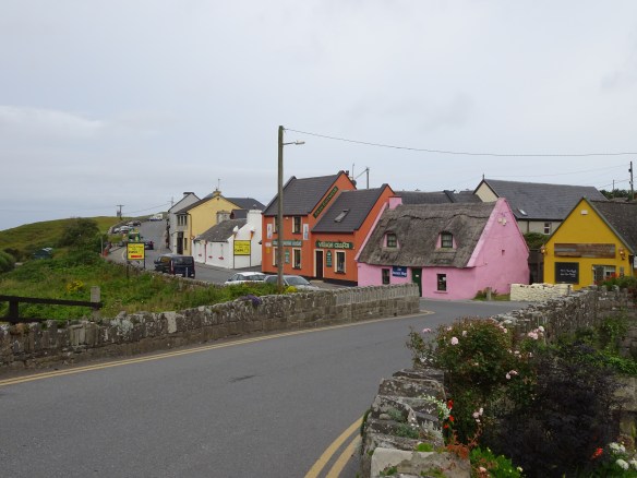
The tiny hamlet of Doolin, justly famous for the traditional Irish music played in its pubs. Our B&B accommodation was just past the left end of this strip of shops and pubs.

Advertisement

Germany’s Romantic Road (Second Half): Dinkelsbuhl to Nordlingen

DSC00875

The view from our hotel window in Dinkelsbuhl, and below…

dsc00886.jpg

… the hotel itself (centre) with an open-air café in front of it.

Dinkelsbuhl is a remarkable town. Its walled centre preserves an astonishing array of wide-fronted, multistorey houses with peaked, steeply raked roofs dating from the 16th and 17th centuries. They stand in packed ranks along the town’s narrow streets. Most are neatly painted in pastel colours – creamy yellow, light orange, beige, moss green. Some stand out in scarlet, lemon yellow or brilliant white. Outwardly they are beautifully maintained with few concessions to the 21st century, but behind the neat facades everything is impeccably hi-tech and modern.

Somehow Dinkelsbuhl avoids being Disney-tacky. The locals are not decked out in faux-medieval costumes. The streets are narrow and cobbled as they were 500 years ago, with, in some cases, houses leaning over and looking down into them, each successive floor overhanging the one beneath. Public signage is in German gothic script. The Brothaus bakery – where we twice feasted on sweet pastries and cake-like bread rolls – tells customers it has been doing business in the same spot since 1616. A soaring 16th century stone church – St.George’s Minster – stands at the hub of the town.

We took a tour of the town in a large roofed cart pulled by two giant horses. As the waggoner – who was also our guide – waited for his cart to fill with customers, from time to time he took a sip from a huge glass of beer, each time returning the glass to its storage place under his seat. Apparently the prohibition on drink-driving doesn’t apply to horse-and-cart drivers.

dsc00896.jpg

The narrow streets of Dinkelsbuhl seen from a horse-drawn cart.

An unpleasant incident occurred during the tour. As we clopped at walking pace through a web of alleys our guide gave us a lively commentary in German. Emmy and I didn’t understand a word of it, but following his outstretched finger we saw exotic sights we might not otherwise have noticed. We enjoyed his eccentric personality and the flow of his patter, and we joined in the outbreaks of laughter from the mostly German-speaking passengers. But a bookish-looking, grey-haired gentleman hugging an English-language guidebook was looking resentful. About twenty minutes into the hour-long tour he suddenly shouted “Stop!” The waggoner put his foot on the brake pedal and called out “Brrrrrr” to the horses. In the middle of a narrow street, with cars queueing behind us, the gentleman with his entourage of three crinkly ladies got off. “It’s all in German!” he announced indignantly (in English) to the German passengers. The waggoner’s eyebrows resumed their place over his eyes, and with the smallest hint of a smile he snapped the reins. The horses clopped forward. It had been a tiny but telling glimpse of English-language arrogance.

DSC00893

Our eccentric, beer-drinking and very personable waggoner-guide.

dsc00904.jpg

The picturesque hamlet of Raustetten. Our accommodation at the Waldeck Hotel is the building visible at the left edge of the village.

The fifth day of the Romantische Strasse took us from the hamlet of Raustetten south of Dinkelsbuhl, over a succession of easy paths 20 kms into the ancient town of Nordlingen. Walking conditions were perfect, with cool temperatures and motionless air under a hazy sky.

DSC00909

Easy walking on the morning of our last day…

DSC00930

… but light rain joined us around 11:00 am and stayed with us for the rest of the day.

But around eleven o’clock small spots of rain began to tick against our faces. The hazy sky was still high and bright, but it cast a fine drizzle over us. We broke out our rain jackets and walked on, hunched under our backpacks like a couple of Quasimodos. The rain stayed with us until we reached the ancient, almost perfectly circular defensive wall around Nordlingen at three in the afternoon. We passed through an arched stone gate into the town’s glistening alleys. We had reached the end of the walk. We averaged 18 kilometres a day over five days.

DSC00906

The religious piety of former times is visible everywhere along the road between Dinkelsbuhl and Nordlingen. Here a forest sign reminds walkers that “God preserves the wilds and woods.” Or is it an entreaty? “God, preserve the wilds and woods!”

DSC00920DSC00917

DSC00922

Here are just three of about a dozen wayside crucifixes on the path between Raustetten and Nordlingen. In the more secular 21st century, perhaps they are speaking to passing hikers. “You think you’re suffering? Look up here. You’ve got it easy, mate!”

Getting into Nordlingen was easy, but it proved hard to escape. The following day I went outside the town’s old walls to the railway station to buy tickets to our next destination, Zurich. The station was hard to find. Under a shroud of canvas behind temporary fencing, it was under reconstruction. It had been totally gutted. There was no ticket office behind the empty eyes of its windows. Amidst the scaffolding on the deserted platform stood an automatic ticket vending machine. Its instructions were all in German (abfahrt, fahrtkarten, bahnhof, gesamt) and I could not bring up Zurich on the screen. We trudged back into the centre of town and headed for the tourist information office.

“Can I go from Nordlingen to Zurich by train?”

The helpful matron behind the counter looked startled. She tapped at her computer.

“You can go by train from here to Aalen, then change to another train to Stuttgart, then change to another train to Singen, then change to another train to Zurich.”

I could see Emmy weighing our two big suitcases in her mind’s eye, then adding the heavy bulk of our backpacks. No way, she signalled to me.

The information officer looked at us with curiosity.

“Why don’t you just leave the same way you came?”

“We walked to Nordlingen from Rothenburg. It’s a long way. We’re not walking back!”

“You walked!?”

She was standing right beside a tall poster advertising the invigorating benefits of walking Germany’s Romantic Road. Evidently it was the first time she had seen a real Romantic Road walker. Perhaps she didn’t expect us to be grey-headed and wrinkled.

My solution was an expensive one. On Saturday, July 13th I hired a taxi to take us and our baggage the 100+ kilometres to Stuttgart Station where I was able to buy a train ticket direct to Zurich. Easy.

DSC00932

Arrival in Nordlingen. Emmy is thriving, while that shrivelled creature in the background is definitely struggling.

Germany’s Romantic Road (First Half): Rothenburg to Dinkelsbuhl

DSC00837

The exotic, beautifully preserved centre of Rothenburg ob der Tauber in Bavaria, western Germany. Our accommodation was a short walk from this square.

Anxious prologue (written July 5th 2019 in Rothenburg ob der Tauber). I’m a bit apprehensive about this walk. Just behind my eyeballs there’s a nagging voice saying “Are you ready for this?” It has been grating at my brain with three unanswerable reasons not to do the walk. First, it says, old age is withering your muscles. You don’t have what it takes to go up and down hills. Yes, it’s true. It’s a rude fact, and I was reminded of it yesterday when we checked into our hotel after a long and complicated trip from Amman in Jordan. The Gerberhaus Hotel is a traditional establishment in a large, picturesque 16th century house not far from the centre of Rothenburg. We were assigned a room under the roof, up three flights of stairs from street-side reception. After four months in Israel, Emmy and I have accumulated stuff, and yes… it’s mostly useless stuff. My suitcase weighs 26 kilos and hers 23 kilos. We also have heavy backpacks. The Gerberhaus has no lift, nor staff to help with luggage. So yesterday I had to haul my 26 kg bag, step by painful step, up to our attic room. Then Emmy’s. How many times did I go up and down those three flights of stairs? Five times, I think, and each time the stairs stretched up higher and steeper. My stringy old muscles were definitely not up to it. I’m feeling fragile. (This afternoon, we’ll pack up all our excess stuff and send it back to Canberra by DHL’s courier service.)

That small, grating voice is also reminding me: “You’re not fit, are you!?” Six weeks ago, we did a four-day hike through northern Israel (see my four reports on The Jesus Trail). Since then I have hardly exercised at all. Jerusalem’s summer heat put a stop to my daily walk from our apartment in the suburb of Katamon to my office at the Israel Institute for Advanced Studies, a return distance of about five kilometres. I had to go by bus. I have lost condition. I can feel that my walking range – my stamina – has taken a big hit. And there’s no time now to build it up again little by little. We start walking the Romantic Road tomorrow with an initial hike of 16 kms.

Then there’s the weather. A week ago, Europe went through an unusual heatwave. Temperatures in parts of Germany sailed up over 40 degrees. I’m looking at my mobile phone right now: tomorrow’s maximum will be around 30 degrees. That’s too hot for two easily dehydrated old people who don’t have the strength or the stamina to carry a big load of water.

The prognosis doesn’t look good. We will walk tomorrow, but we are going to suffer.

DSC00823

Emmy walks through an ancient gateway into the centre of Rothenburg town.

Report from Schillingsfurst, our first stop. As predicted, July 6th dawned dry and hot. As we walked out of Rothenburg at 9:00 a.m. the sun was already like a branding iron in the cloudless sky. Initially there wasn’t much shade. We walked through quiet fields of beige-yellow spelt-wheat and bright green corn. Luckily our trail notes (supplied by Macs Adventure: https://www.macsadventure.com/holiday-1479/germanys-romantic-road ) were detailed and clear, and the trail markers along the route were frequent and clearly visible.

DSC00844

Much of our route was on smooth minor roads through rich farmland.

But by the village of Bochenfeld, less than half-way through the day’s walk, attrition had climbed like a gorilla onto our shoulders. It was a relief to enter a stretch of shadowy woods and sit for half an hour on some fallen logs. We ate a little and drank a lot, enjoying the restorative quiet. Tiny waspish-looking flies traversed my outstretched legs, hovering like tiny helicopters on a reconnaissance mission over the ridges and gullies of my clothes, sniffing out my sunscreen lotion and salty sweat. There were a few lazy chirps in the trees, but otherwise all was silent. A church bell tolled from kilometres away, muffled in the heavy heat of late morning.

In the afternoon our stops became more frequent, but around 3:00 pm we managed to edge into the village of Schillingsfurst – wrapped in Saturday afternoon somnolence. From the terrace of our accommodation at the very welcoming Die Post Hotel, high on the slope of a valley, the countryside rolled out to the horizon: orange roofs of farmsteads amid a quilt of corn and wheat fields, belts of dark forest, small villages holding fast to the spikes of their church towers, high-tech ridge-top windmills slowly, gracefully waving their slender arms in the late afternoon breeze.

DSC00855

A typical country hotel along the Romantic Road: our accommodation in Schillingsfurst.

It was a relief to reach our destination, but in a kind of mild delirium I made a mistake. I drank a big stein-mug of Bavarian beer, then at dinner devoured slabs of beef that (the publican told me proudly) had been marinated in rich red wine for six days, and followed it with an ice-cream dessert dressed in a high-octane liqueur. The combination of alcohol and dehydration triggered an attack of gout in my right big-toe joint. The following morning I was yelping in pain and limping. The day’s walk to Feuchtwangen – 22 kilometres – grinned at me in evil anticipation of my suffering.

DSC00868

A selfie in the cool of the forest.

DSC00859

Ouch! Ow! You can’t see my face, fortunately, but my gout-ridden toe is killing me.

Dear reader, I won’t impose on your reserves of sympathy with details of my agony. Anyway, I don’t remember much of the day… I was walking through a paracetamol induced fog. Somehow the kilometres crept past like ghosts. At least the temperature had fallen to around 20 degrees. As we walked unsteadily into Feuchtwangen I swore a solemn oath: never again any alcohol of any kind in any quantity during this month of walking. And… success! I have strictly observed the oath for a whole two days.

dsc00867.jpg

After our hot first day of walking, we are religious about keeping well hydrated.

We have found the Germans we have met to be warm and friendly, tolerant of our practically non-existent command of German, and wonderfully ready to help. We had two examples of this as we left Feuchtwangen. I asked our hosts at the Karpfen Hotel to prepare two packed lunches for us to eat on the road the following day. As we checked out, our lunches were handed to us.

“How much?”

“Oh, no charge,” was the smiling reply. Inside each pack we found three freshly cut sandwiches (thick cheese and ham), a tomato and a boiled egg. Free! On the edge of town we stopped to buy water at an old mill that had been turned into a popular restaurant. The proprietor emerged with a big bottle of top-quality mineral water.

“How much?”

“Oh, no charge,” was the smiling reply. And we hadn’t even entered the restaurant!

DSC00863

Just outside Feuchtwangen, the converted old mill where we were given free mineral water.

This earthy generosity lent wings to our feet. My painful toe had settled down, the rich green fields and shade-filled forests flashed past, and by three o’clock in the afternoon we were passing under Dinkelbuhl’s tall, red, medieval clock tower. Survival is a kind of success, and we had survived the first half of the walk. Time for a day’s break in the exotic surrounds of “Germany’s most beautiful old city”.

DSC00873

On the outskirts of “The most beautiful old city in Germany”. (More on Dinkelsbuhl in the next post.)


The Jesus Trail, Day 4: Arbel to Capernaum, and home to Jerusalem through the West Bank

According to the Jesus Trail guidebook (Walking the Jesus Trail by Anna Dintaman and David Landis), the path from Arbel…

…follows the Israel Trail blazes on a steep but beautiful route down a cliff face. […] Be careful as you descend. There is a bridge with handholds in the rock to assist you in the steepest section. The path can be slippery when damp, and park authorities do not allow hikers to descend in wet weather.

This put the wind up us. We were not reassured by the history of the cliff. According to the historian Josephus in his Jewish War (written around 75 CE), the troops of Herod the Great winkled Jewish rebels out of their holes in the Arbel cliff “by lowering down his soldiers in large baskets on ropes to pull out the rebels, causing them to fall to their deaths.”

For us, clearly discretion was going to get the better of valour. Still suffering from the exhaustion of the previous day’s walk we decided to take a taxi from our overnight accommodation, past the cliff-face descent, down to the edge of the Sea of Galilee / Kinneret. Please forgive us, dear reader.

At the town of Tabgha we joined a throng of tourists and wide-eyed Christian pilgrims at the Church of the Multiplication of Loaves and Fishes. According to all four Gospels, at Bethsaida, about seven kilometres north-east of modern Tabgha, Jesus turned two fishes and five loaves of bread into a meal sufficient for five thousand people. There was even food left over. (I’ve always wondered whether the fish was cooked or not. Did the 5,000 have to light fires and cook the fish, or was it miraculously already cooked when distributed. Just asking.)

In the Church of the Multiplication of Loaves and Fishes visitors light candles before a Greek-style icon of Jesus. They also pray, prostrate themselves on the floor, and (of course) take photos. A picturesque, Byzantine-style mosaic representing fish and loaves lies stamped into the floor in front of the altar. The image has been turned into a hundred different souvenirs snapped up by tourists in the adjacent gift shop. We too invested. We bought the image on a set of table mats that (hopefully) will help us feel more thankful as we tuck into our regular meal of grilled salmon and bread rolls back in Canberra.

Fish and loaves

A Byzantine-style fish and loaves image on the floor before the altar of the Church of the Multiplication of Fishes and Loaves in Tabgha.

DSC00601

The faithful prostrate themselves on the floor before the altar.

No more than two hundred metres down the road stands the lakeside Church of the Primacy of St. Peter. It commemorates the moment recounted in the Gospel of Matthew (chapter 16 verses 16-18) when, after his resurrection, Jesus spoke to his friend and follower Simon Peter, telling him “you are Peter, and on this rock I will build my church.” Jesus was making a play on words. “Peter” is derived from the Greek word “petros” meaning “rock”. (Peter’s Aramaic name Cephas is also taken to mean “stone” or “rock”.)

DSC00608

Hammering home the metaphor, a large rock fills the Church of the Primacy of St. Peter, believed by many to be the first leader and the founding “rock” of the Christian church.

DSC00607

A sign at the front door of the Church of the Primacy of St. Peter. As a die-hard religious sceptic I interpret the sign to mean “This is a church, rational explanations have no place here… please, no thinking allowed, just have faith”.

The relentless crowds inside the beautiful but simple church have compelled real worshippers to shift outside. Under trees beside the church there is a small open-air chapel where we saw priests conducting a Catholic mass for a congregation of about 25 devotees. Nearby, visitors crowded a small, pebbly beach and looked out across the calm of Kinneret towards the Golan Heights on the opposite shore. Some removed their shoes to stand ankle-deep in the holy water, dextrously recording themselves with selfies as they did so.

DSC00606

We have arrived. I stand outside the Church of St. Peter in Tabgha, and below…

DSC00613

… Emmy stands on the pebbly shore of the Sea of Galilee, near where Jesus is said to have walked on water.

The final leg of our walk took us three kilometres along a picturesque, neatly paved, lakeside path to a park built around several small religious buildings on the long-abandoned site of Kfar Nahum (Capernaum), the village where Jesus is said to have based his ministry. We had reached the end of the 65 kilometre Jesus Trail. After subtracting the taxi rides in Nazareth on the first day, and Arbel on the last day, we had walked somewhere between 50 and 55 kilometres. We had seen much of the beauty and diversity of Israel, as well as its disturbing divisions. And our ancient bones, muscles and brains had survived the rigours of the walk. We felt pretty satisfied with that.

Postscript

Exhaustion was still clamped around our legs like manacles, so we decided to return to Jerusalem direct by taxi. Our driver took us around the northern curve of Kinneret and down the eastern shore, squeezing between the lake to the west and the beetling presence of the Golan Heights to the east. We went south through the town of Beit She’an and, unchecked, through a border crossing into the Israeli-occupied West Bank. We were on Highway 90, which is forbidden to Palestinians except with special permits. It runs the full length of the occupied West Bank. In the northern sector it sticks close to the Jordan River. The countryside left and right of the road has largely been de-populated (for “security reasons” say the Israelis). Ethnically cleansed is a more accurate term. The former population of Palestinian Arabs has been uprooted and shifted west, mostly to the major urban centres of Nablus, Ramallah and (further south) Hebron. In the northern sector the eerily empty landscape is filled with low hills of tawny grass, punctuated here and there with market gardens and plantations of dates, olives and bananas. In places there are derelict houses of the former Arab population, and once, we saw rows of stumps marking (according to our Jewish driver) a destroyed Palestinian olive grove. Here and there the highway passes squalid Bedouin communities, their tents filled with goats and surrounded by litter. The highway curves around the Palestinian town of Jericho, just north of the Dead Sea, and heads west into Jerusalem, passing signs pointing left and right to the prosperous Jewish settlements of Ma’ale Adumim. On this Jews/foreigners-only route, Palestinians are rendered almost invisible in their own land.

The occupied West Bank and Gaza are the conscience of Israel… and it is a very ugly sight.

The Jesus Trail, Day 3: Kibbutz Lavi to Moshav Arbel

We stepped from the friendly ambience of the Kibbutz Lavi Hotel into the mild warmth of a clear Thursday morning. Our path took us across the central installations of the kibbutz: chicken runs, cow sheds, a petrol station, yards full of agricultural machinery, stables, workshops, offices, staff houses…

We walked along a well-defined path into neat fields, curving towards the low prominence of the Horns of Hattin. The big hill has a couple of lumps in it like protrusions growing on the head of a young bull. Everywhere in Israel visitors are either ogling history or trampling over it. Here you can do both. In 1187 Crusader forces clashed with the Muslim army of Saladin in the open country under the Horns of Hattin, right where we were walking. Saladin routed the Crusaders, putting an end to European Christian power in the Levant until Napoleon turned up at the end of the 1700s.

We reached a T-junction in the path, with an innocently inviting turn to the left and an equally inviting wriggle of pathway to the right. Both options were marked with trail blazes, so we consulted our map. The path to the left looked shorter. No-brainer… we turned left.

A gently rising staircase took us upwards and around the contours of the hill. A vast panorama opened up beneath us: the distant white roofs of factories and glasshouses glinting in the sun, shimmering villages and townships, green and yellow fields, a busy highway with insect-like cars creeping along it. We gulped big breaths of clean air and stopped for a selfie or two. How good it was to walk free and strong with the world spread out below us.

3Jesus_G_poses_on_Hattin_heights

I pose on the heights between Lavi and Arbel, innocently (or arrogantly?) unaware that our old age is about to be tested on surfaces rougher than we’ve ever walked on before.

Hmmm… within an hour that sentimental froth had been whipped away from us. The path turned nasty. REALLY nasty. A trap snapped shut… there was no turning back. For the next four hours we had to struggle forward over the most difficult walking terrain we have ever encountered in the ten years of our walking careers. It wasn’t a long distance, but it was slow going and harrowing while it lasted.

3Jesus_rocky_path_with_blaze

Here is our “path”. Yes, it is an “official” pathway. Note the trail marker on a rock bottom left.

3Jesus_rocky_path_with_Emmy

Emmy comes up a slope, balancing precariously on the rocky surface.

The track ascended and descended steeply, sometimes precipitously. Over considerable distances (at least it felt “considerable” to us) the surface was boulders and rocks. Not a “path” at all. Yet it was the path, marked at regular intervals with official trail markers. We couldn’t leap from boulder to boulder as young walkers might have done, or mountain goats. In places we had to wobble forward, inch by tiny inch, testing every step with our poles, maneuvering among the crevices, crawling, or sliding on our bums in places. Being old, we were fearful of a fall or a sprain. At one point I slipped on to my back between two rocks. I couldn’t fold my legs under me, or find support for my arms on the smooth surface of the stones. Emmy couldn’t get close enough to help. It took me five minutes to get upright. The combination of old age and boulders is not a good one.

3Jesus_rocky_ascent_with_Emmy

Maybe over that crest the path will smooth out and it will be easy going again. Totally alone, we had no help but hope.

When we emerged from the grass and stones above the village of Kfar Zeitim, we were aching, dehydrated and exhausted. In the distance we could see our destination, the hamlet of Moshav Arbel. Behind it, through a gash in the hills, we could also see the burnished steel of Kinneret, the Sea of Galilee.

3Jesus_view_to_Arbel_&_Galilee

Kinneret visible in the distance, and our destination, Moshav Arbel, visible centre-right. We still have around two hours of walking (trudging? plodding? staggering?) ahead of us.

Another hour brought us to a highway leading east towards Arbel. As we drooped along the shoulder of the road a car skidded to a stop beside us.

“Need a lift?”

A miraculous flash of energy teleported us instantaneously into the car where we met Corinne, the young driver. In ten minutes she had whisked us to our accommodation at the Arbel Holiday Homes. We thanked her profusely, but we couldn’t find words to tell her how deep our gratitude really was. Corinne didn’t care. In the spirit of true generosity she simply gave us a cheery wave and drove off.

The proprietors of Arbel Holiday Homes, Ben Konowitz and his wife, greeted us warmly and ushered us to a simple but comfortable cabin. I started to tell Ben of our sufferings. With a glimmer of Jewish humour and the slightest of smiles, he waved my lament away.

“You’re walking the Jesus Trail,” he said gently. “You’re supposed to suffer.”

The Jesus Trail, Day 2: Cana to Kibbutz Lavi

A jostling crowd of pilgrims and tourists jammed the front door of the Cana Wedding Church. (Cana is often mispronounced /kay.na/. It should be /ka.na/.) Emmy and I elbowed our way in and took a seat in the back row of pews. Under its bright red dome the church hosts a spacious nave and a light-filled transept. As we took in the ambience, a church functionary tried to shoo the crush of selfie-snapping visitors out.

2Jesus_Indians_in_courtyard_of_Cana_church

Christian visitors from southern India milling around in the Cana Church courtyard…

2Jesus_Inside_Cana_Church

… and inside the church tourists mingle with devout worshippers.

We were about to witness what the Cana Wedding Church is famous for. At the front of the nave, standing in a semi-circle before the altar, stood seven middle-aged American couples. One of the grey-haired ladies was wearing a bridal veil and holding fast to the hand of her slightly stooped, somewhat paunchy husband. They were all there to reconfirm their marriage vows. A Catholic priest appeared and launched into a short service. With sing-song enthusiasm he read from the second chapter of John’s Gospel.

On the third day there was a wedding in Cana of Galilee, and the mother of Jesus was there, and both Jesus and his disciples were invited to the wedding. When the wine ran out, the mother of Jesus said to him, “They have no wine.” And Jesus said to her, “Woman, what does that have to do with me? My hour has not yet come.” His mother said to the servants, “Whatever he says to you, do it.” Now there were six stone water pots set there for the Jewish custom of purification, containing twenty or thirty gallons each. Jesus said to them, “Fill the pots with water.” So they filled them up to the brim. And he said to them, “Draw some out now and take it to the headwaiter.” So they took it to him. When the headwaiter tasted the water which had become wine, and did not know where it came from (but the servants who had drawn the water knew), the headwaiter called the bridegroom and said to him, “Every man serves the good wine first, and when the people have drunk freely, then he serves the poorer wine; but you have kept the good wine until now.

2Jesus_marriage_reconfirmation_vows

Middle-aged couples from the United States reconfirm their marriage vows.

The best wine is well-aged wine and is drunk later in life. That was the message of the priest’s brief sermon on marriage, interrupted with giggles as the couples exchanged their renewed vows and wedding rings. The twenty-minute service wound up with a chaste kiss (“…just a very brief kiss!” warned the priest, but he was grinning as he said it.)

In the alley outside, the souvenir shops were doing a brisk trade in (what else?) wine. I sampled some. It was very red and very sweet, like sherry or rich port. I was deep in the narrative and reached for my wallet. Then I remembered, wine = weight. A day of walking lay ahead of us. There are certain trials that no amount of wine, however old and rich, can make smooth. I chose light luggage over a light head.

2Jesus_Grey_cactus_grey_rocks

Some of the walk to Kibbutz Lavi was tough. Here Emmy picks her way over grey rocks between grey, rock-hard cactus plants.

2Jesus_Emmy_drinking_under_a_tree

The temperature hovered around 25 degrees. It wasn’t uncomfortably hot, but we had to stay well-hydrated

May 8th took us from Cana to the prosperous orthodox Jewish kibbutz at Lavi, a distance of about sixteen kilometres. We would be crossing an unmarked but nevertheless real apartheid boundary between Arab towns of Cana and Tur’an, and the Jewish territory of Lavi. Our route took us over open, empty countryside and through the Beit Keshet Forest. This so-called “forest” was sparse and degraded, struggling to live right beside a military base complete with barbed-wire fences and guard towers. But we felt at home… the forest was populated by large clusters of Australian ghost gums with their messy leaf litter and whiff of eucalyptus perfume. Even… could that be a dingo!? It was in fact a jackal. It darted on to our gravel path, stared at us for a split-second, then vanished. Again, we were completely alone, surrounded by sweet silence and sweet solitude.

Around midday we reached the Golani Junction, a major meeting point of the north-south and east-west highways in northern Israel. The trail took us past a McDonald’s restaurant and into rough farmland. The ground was stony and splotched with rock-hard dry mud well trampled by cattle. Large grey cactus plants leered over us. We reached a barbed wire fence hanging over boulders. This was a crossing point, but it took us a good ten minutes to find a way through the swaying, razor-sharp confusion of wires.

2Jesus_Arab_lunch_near_Turan

We had lunch in a roadside Arab restaurant. “We want a light, simple lunch,” I told the waiter. “OK, OK, no problem… very small meal.” And this is what we got. On my plate: chicken schnitzel with sesame seeds, chips and rice. Then clockwise from the left of my plate, savoury rice, gherkins, olives, roast slices of eggplant, hummus, flat bread, fresh salad, and various relishes. Emmy has chicken kebabs on long steel skewers. And after eating as much as we could, we were invited to shift to another table for….

2Jesus_Coffee_after_lunch

… explosively strong Turkish style coffee and various sweetmeats.

By mid-afternoon we could see the Kibbutz Lavi Hotel, a substantial grey concrete building atop a high hill across neatly tilled fields. But somehow, the road we were on circled around the hill. It was an hour of plodding, culminating in a steep, hot climb to the kibbutz entry gate, before we reached the haven of the hotel. The welcome was warm and soon we were stretched out on a soft bed in a modestly luxurious room feeling the fatigue ebb away.

We enjoyed a smorgasbord dinner in a large dining hall with scores – perhaps hundreds – of American Jews in tour groups, mixing it with kibbutz staff. The atmosphere was relaxed and convivial, brightened by the excited chatter of children. We felt comfortably at home. A wide range of Jewish styles was on display, from smooth shaven young men sporting crew-cuts and wearing shorts and t-shirts, to figures with corkscrew side-locks wearing black kippa skull caps and creamy prayer shawls under their dark jackets and waistcoats. Many women hid their hair under colourful turban-like headcloths, their modest dresses reaching down to their ankles.

It was Independence Day, which is always the day after Memorial Day. Everywhere there were Israeli flags: on the tables, hanging from the ceiling, decorating the food bars. The atmosphere was mildly exuberant and there was a special range of foods on offer: plentiful, very varied and delicious. Thinking with regret of my decision that morning not to buy a bottle of wine in Cana, I corrected my mistake and bought a mini bottle of red. The Jewish gentleman at the next table lifted his eyes from the mountain of roast meat and eggplant on his plate to point at the bottle and congratulate me on my taste. “Yes, it’s not bad,” I admitted. “Not bad!!??” he bristled. “That’s from the Gamla Winery in the Golan Heights. It’s the best wine in the world!”

I wanted to argue the case for New Zealand Pinot Noir, but my neighbour had headed back to the food bar and was busy heaping a second (or maybe a third?) helping of meat and eggplant on to his plate.

2Jesus_Emmy&G_selfie

On the way to Kibbutz Lavi, still managing to look cheerful. Little did we know… (see next post)