The Jesus Trail Day 1: Nazareth to Cana

Nazareth is the starting point of the so-called Jesus Trail, a 65 kilometre, four-day hike down to the Sea of Galilee in northern Israel. Two thousand years ago Nazareth was a tiny village where, supposedly, Yeshua ben Yosef (better known as Jesus) grew up. Today, with a population nearing 80,000, it is Israel’s biggest Arab city. Most people there are Muslims, but about 30% identify as Christians, mostly Catholic.

1Jesus_GQSelfie_Basilica

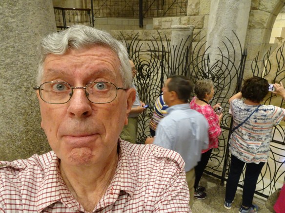
“The journey of a thousand miles begins with a single selfie.” I’m in the Basilica of the Annunciation in Nazareth, bringing Lao Tze’s ancient aphorism into the 21st century. Behind me tourists take pictures of the cave where Mary was told of her divine pregnancy.

1Jesus_Villa_Nazareth

Our accommodation in Nazareth, the basic but very welcoming Villa Nazareth.

Airily throwing aside our burden of years (we’re now both on the wrong side of 75) Emmy and I signed up for the Walk as independent walkers whose baggage would be transferred by Abraham Tours from lodging to lodging along the way (see: https://abrahamtours.com/tours/jesus-trail/ ). The first leg, from Nazareth to Cana, would take us sixteen kilometres into the journey.

We checked in to the basic but squeaky-clean first stop, the Villa Nazareth B&B hotel among the twisting alleyways of Nazareth’s old city centre. We had some preliminary reconnaissance to do. Our guidebook mentioned that the walk out of Nazareth began with a steep flight of 405 steps. On our first evening in town we walked through the ancient stone passageways to the foot of the steps and peered up. One glance and our elderly legs began to tremble. Our knees sent painful signals clambering up our fragile nerve-paths to register a warning… “You’re very old, don’t risk that climb!”

1Jesus_Basilica_exterior_Nazareth

The exterior of the huge Basilica of the Annunciation in Nazareth…

1Jesus_Basilica interior

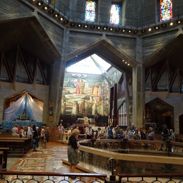
… and inside pilgrims, tourists and devotees of Mary swarm through the spacious, second-floor of the basilica.

Back at the Villa Nazareth I had a word with Razie, the ultra-helpful receptionist: “Could you arrange a taxi to take us to the top of the steps tomorrow morning?” Razie managed to look both surprised and not surprised. “Of course,” he said. “Very sensible.” Then he nailed me with a friendly but stern glare. “You should take a taxi right to the edge of Nazareth,” he said. “Almost every day we have to deal with walkers who get lost in the tangle of streets around the top of the steps. There’s a lot of construction going on up there, the way is not clearly marked. It’s very demoralising to get lost before you’ve even started.”

1Jesus_Alleyway_with_lampsb

Above and below: the narrow streets and alleys of old Nazareth

1Jesus_Narrow_alley_Nazareth

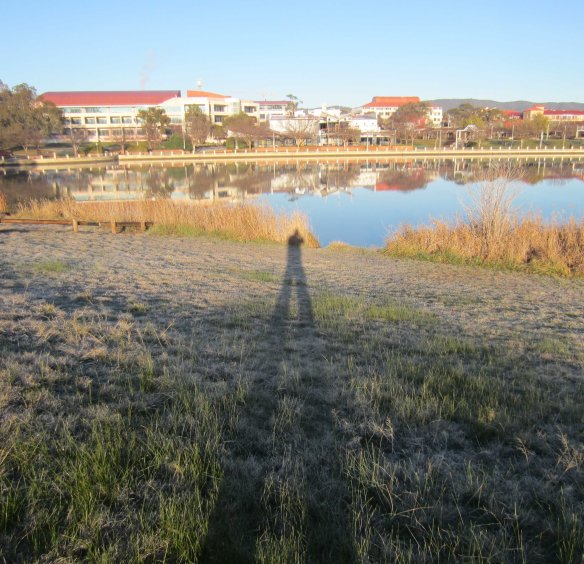
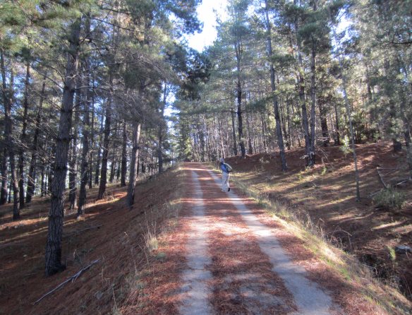
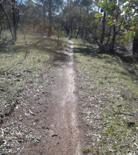
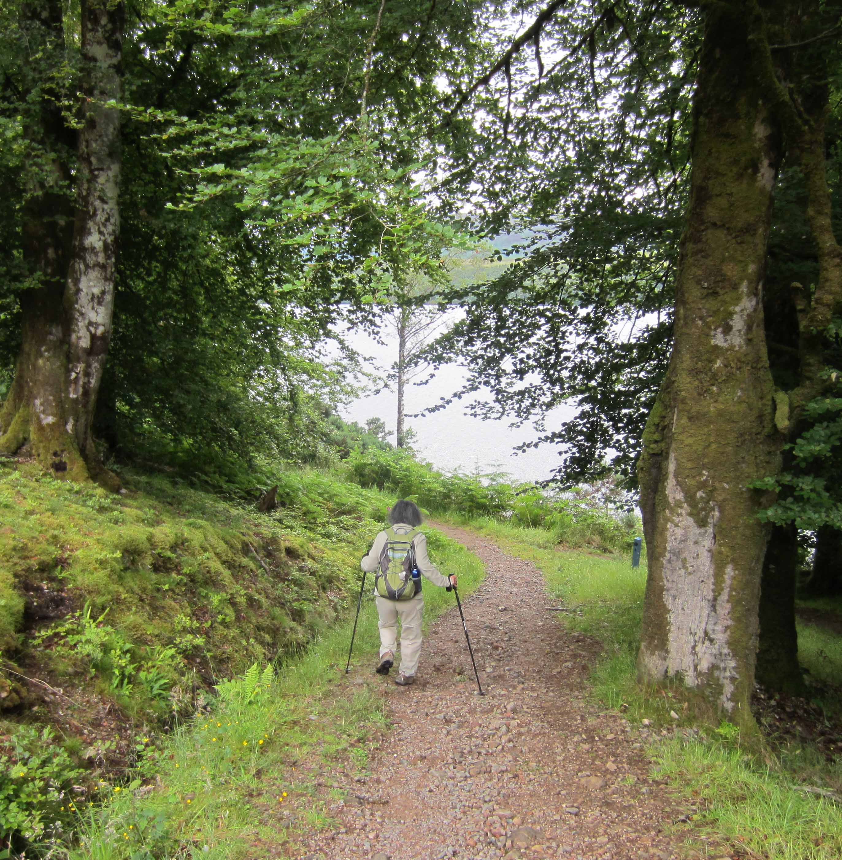
I tried to look as if we didn’t really need to by-pass this initial obstacle, but inwardly I snapped up Razie’s advice and immediately ordered the taxi. The following morning, Tuesday May 7th, beyond the edge of Nazareth city, a short walk took us into a sparse, scraggy, rubbish-strewn forest. We were utterly alone. The weather was clear and warm but with a cooling breeze. The feared 30+ temperatures didn’t eventuate. The path was well-marked with frequent white and orange trail markers on trees and rocks. We strode forward confidently, jabbing our walking poles into the stony ground, scanning the rocks and trees ahead for the trail-markers that would take us down to the waters of Galilee. We were on our way!

1Jesus_GQ_with_first_blaze_Zippori

These trail markers – called “blazes” – appear about every 150 metres or so (usually) and will guide us 65 kilometres down to Kfar Nahum (Capernaum) on the Sea of Galilee.

1Jesus_Rubbish_in_forest

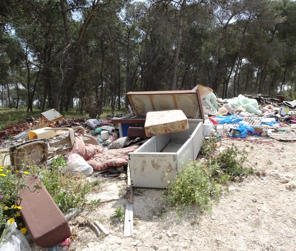
Israel’s forests are quite degraded. Some people treat them as rubbish dumps.

Around mid-morning we walked into Mash’had, a quiet, almost deserted, little town of multi-floor stone houses. Under Israel’s apartheid-like patchwork of segregated communities Mash’had is labelled “Arab-Muslim”. Like most towns in Israel it lays claim to a special connection with the distant past. Jonah (called Yunus by Muslims) was born into history there three thousand years ago. He got eaten by a giant fish and survived. In the course of time, story becomes history, so Jonah’s grave in Mash’had is proof-positive that he really did survive a three-day sojourn in the belly of the fish.

Heading out of Mash’had we stopped for a drink at an open-air café in the garden of a big, stone villa. The lady of the house apologised she couldn’t keep us company, and after putting cool drinks before us, she tugged at her hijab scarf and leaped into a car. “You here… at home!” she called, revving the car and disappearing into the streets of the town.

From the garden we looked across to the town of Cana spread out as dense and white as a ragged lace curtain along the opposite slope of a small valley. This was our destination for the day, but crossing the valley turned out to be an ordeal. The “path” was a rocky ditch that dipped and zig-zagged among olive trees, tall tough grass, and herds of goats. But we got there. After threading our way through narrow alleys around Cana’s famous “Wedding Church” we checked in to our ultra-simple but very welcoming accommodation at the Cana Wedding Guesthouse.

1Jesus_Aussie_bottlebrush_Mashhad

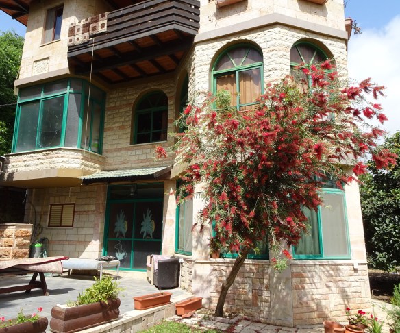
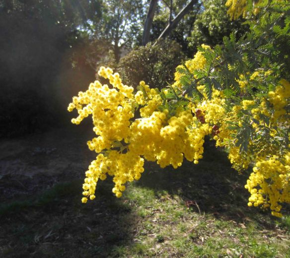
Australian gum trees are everywhere in the forests along the Jesus Trail, and here we have a bottlebrush thriving in the garden of a villa in the Arab town of Mash’had.

1Jesus_Sammy_with_hookah

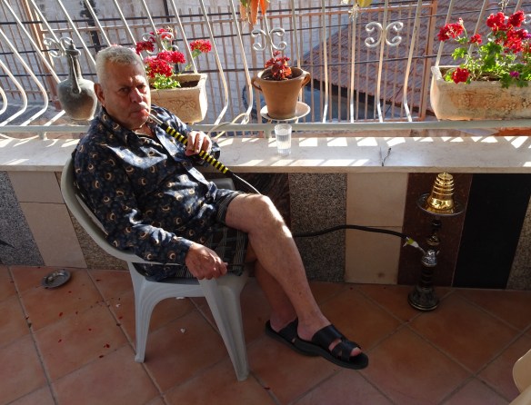
Sammy, our affable host at the Cana Wedding Guesthouse, enjoys the apple-flavoured tobacco of his hookah.

The strong aroma of fresh apples hung in the warmth of the late afternoon air. Sammy, the affable proprietor of the Cana Wedding Guesthouse, was sitting on the balcony-verandah, his mouth clamped over the mouthpiece of a hose that led to a hookah on the floor. Thick clouds of sweet-smelling smoke tumbled from his mouth accompanied by cheerful gurgling from the hookah. Between each puff, Sammy’s face broke into its trademark mile-wide smile.

1Jesus_Nakba_sign_Nazarethb

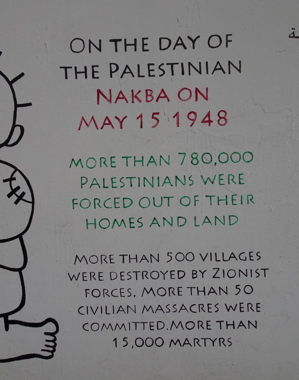
This sign, on a wall in Nazareth, accurately sums up the disaster that overtook the Arabs who had legally lived in their homes and farmed their lands in Palestine for a thousand years. There is fault and ill-will on both sides in the Palestine-Israel dispute, but far more than any other issue, it is this clear, unresolved injustice that keeps the enmity alive.

But at eight o’clock the smile suddenly froze and disappeared. It was May 7th and across the small town of Cana a siren sounded, marking the beginning of Israel’s Memorial Day commemorating soldiers who have fallen in the country’s wars. Understandably, most Palestinian Arabs, like Sammy, do not celebrate this day. As in many public events in Israel, Palestinians are excluded. The state actively lobbies to discourage the small but growing number of Israelis who, on this grief-laden day, try to hold a joint Israeli-Palestinian grieving for the thousands of lives lost, Palestinian and Jewish. This year they held it by torchlight in a park in Tel Aviv. Arabs and Jews who took part were subjected to spitting and abuse from a crowd of racist ultra-right Jews. They were aided and abetted by the government which tried to stop Arabs from the occupied territories from crossing into Israel to attend the commemoration. Israel is a Jewish state – the official line runs – so reconciliation and inclusion are not (officially) on the agenda.

More on Cana’s famous wedding in the next post.

Advertisement

Winter Walking in Canberra: A two-banana walk to Weston Creek

You can measure a walk in steps and kilometres. I have a Garmin Vivofit wrist band that does this, as well as a Runkeeper GPS tracker app on my mobile phone. These devices are pretty accurate. They tell me that this morning Emmy and I walked 16,247 steps over a distance of 12.67 kilometres. But somehow this is not precise enough for me. I find it more scientific to measure a walk in terms of bananas consumed and bottles of Diet Coke drunk. By this measure today’s walk was a two-banana, one-Coke walk. It took us from home along Lake Tuggeranong through the parkland of Kambah and the suburbs of Weston Creek to Cooleman Court shopping centre.

Two_bananas_map(b)

Our route from Lake Tuggeranong to Weston Creek. It took a little over three hours.

As always we were on the road at around 7.30 am. The temperature was minus-2 degrees, the sky cloudless, the air rigidly still. Have you ever noticed how slowly the sun rises in winter? It lays cold planks of sunlight across the landscape that somehow don’t move. It refuses to rise above the tree-tops. It is constantly sparkling among branches and flashing between tree trunks as you walk through parkland. It took us three hours to reach Weston Creek and as we approached Cooleman Court the sun was still yawning and stretching out along the ridge of the shopping centre’s roof.

Two_bananas_shadow_over_lake

My plastic-man shadow points across Lake Tuggeranong to the Tuggeranong town centre.

Lake Tuggeranong is oriented more or less north-south. From the familiar path along the east shore we looked down the rolled-out length of our shadows across the water to Tuggeranong College and the Hyperdome Mall. Their tranquil upside-down images were sliced by the scalpel of a rowing boat as a lone oarsman replayed last night’s Olympic races on the smokey water.

Two_bananas_ibis_cranes

Ibis cranes enjoy the morning sun on the shore of Lake Tuggeranong.

Just off the north end of the lake we came upon a Lao Buddhist social centre, the Wat Lao Buddhanimit, a small but exotic-looking building with an orange-tiled Lao-style roof and brick fence posts topped with lotus buds. Buddha was reclining in the yard looking into the frosty sun and the grey silhouettes of Australian gum trees. He looked pretty much at home.

Two_bananas_Lao_Buddhist_centre

The Lao Buddhist temple and community centre.

Two_bananas_Buddha_&_rising_sun

Buddha wakes up to the icy sunlight of a winter morning at the Lao community centre.

Further on I paused to grind my teeth as we passed a children’s play area. A sign warned that the skate bowl was “inherently dangerous and may result in injury to the person and/or property loss or damage.” Regular readers of this blog will have noticed I have little patience with the excesses of the “risk management” industry and their groupies in insurance companies, the legal profession and the crowded ranks of gormless parents (see for example: https://walktenthousandmiles.net/2012/04/16/review-across-europe-alone-on-foot-aged-eighteen/ ). By nagging us incessantly about risk avoidance – even the tiny risks of a playground – they are doing damage to the resilience of Australian children. And it’s not just children. My special bête noire is the warning screen that precedes many television programs, programs that some anonymous individual thinks may put you at risk of being discomforted by reality. You’ve seen them.

“The following program has content that may concern some viewers.”

(This is not a sarcastic exaggeration… it is quoted here verbatim from several ABC television programs.) Last time I saw this dumb announcement I almost threw a shoe at the TV set… but I thought better of it and threw a sock instead. The TV was not damaged and I felt a little calmer.

Two_bananas_warning_sign

Watch out kids! Death awaits you in this playground.

Not far from the mortally dangerous children’s playground we came to the battered remains of a woolshed. Originally built in the late 19th century it has been partially rescued and turned into a picnic shelter. It is a low-key but exotic reminder that Canberra has sprawled across what was once productive farmland. Right beside the woolshed lies a community garden. Crusted with frost, its many small plots were full of kale, cabbage, broccoli, silver beet and a multitude of little-known vegetables like Japanese komatsuna, daikon and bekana cabbage. The garden is a tribute to the determination of local people, many of them recent migrants, to fight back against the urban neutering of farmland fertility. As they turn the soil they have found old horseshoes, and the metal parts of horse-drawn ploughs and carts.

Two_bananas_woolshed

The remains of a 19th century woolshed now a picnic shelter popular in summer…

Two_bananas_Kambah_community_garden(b)

… and the adjacent community garden where horseshoes and metal parts of horse-drawn ploughs and carts have been dug up.

A little over seven kilometres into the walk, across Drakeford Drive from the Kambah Shopping Village, we stopped for a rest at the side of a football field. I ate the first of my bananas and sipped water. Then it was on to the nearby intersection where we would strike left up Namatjira Drive towards Weston Creek. On the other side of the intersection I saw a large box-like building with the word Eternity staring in large letters from its featureless, grey wall. From a distance I thought it might be a factory, perhaps manufacturing washing powder or perfume. But it is in fact a church in the pentecostal-charismatic mould. According to the church’s web site “It has been said many times that Canberra is a city without a soul. Our goal is to change this.” Sounds noble and generous, doesn’t it, especially when you don’t bother to define the word “soul.”

Two_bananas_rest_break

Time for a quick snack and drink.

Two_bananas_Eternity_beckons

A grim-looking Eternity beckons near the intersection of Sulwood Drive and the Tuggeranong Parkway. But the location is perfect… the intersection is an accident hot-spot.

Between 1932 and 1967 a former soldier, petty criminal, alcoholic and late-life convert to Christianity by the name of Arthur Stace wandered the streets of Sydney by night chalking “Eternity” onto footpaths and walls. It is estimated he wrote the word more than half a million times. The people of Sydney – whose lives revolve around making money, shopping, sport, drinking and loafing at the beach – eventually noticed it and (characteristically) registered it as a trademark. Today the word has acquired mantra-like status in some corners of Australia’s Christian community. Canberra’s Eternity Church used to be known as the Parkway Church (named after the adjacent highway) but a few years back it changed its name, choosing to surf on the unique history and spooky overtones of “Eternity.” The church is popular, so it was a good marketing move.

Two_bananas_wattle_blooms

Wattle on fire, an early sign of spring.

The last leg of the walk took us through the leafy suburbs of Chapman and Stirling down to Hindmarsh Drive and across to the Cooleman Court shopping centre. There we enjoyed a leisurely drink before catching a bus to Woden, then another south to Tuggeranong and a final walk of two kilometres back home. I felt quietly pleased. Sure, it was only a two-banana walk, but it had taken us through varied environments: suburban footpaths, beautiful tree-filled parks, lakeside pathways, farmland, even a modestly testing hill.

And at the end of the walk there were no distress signals of any kind from any quarter of my ageing body.

Two_bananas_Coke_at_Cooleman

At Cooleman Court shopping centre I measure the distance we have travelled.


Winter Walking in Canberra: The Great Lake-to-Lake Trek

It was (would you believe) my birthday present to myself. What on earth was I thinking?

Emmy and I would walk from our home near Lake Tuggeranong in the southern suburbs of Canberra, to Lake Burley Griffin in the centre of the city. The route I had figured out meandered through nature reserves and suburban streets, side-swiping Parliament House before crossing Lake Burley Griffin along Commonwealth Avenue. We would be walking over a variety of surfaces, from streetside footpaths, to bicycle paths, to muddy tracks, to gravel access roads in reserves and parks. It was mostly fairly flat, but Waniassa Hills would set our jugulars pulsing. There were just two clusters of shops along the route, Erindale and Red Hill, so we decided to carry all our water and food with us.

Lake-to-Lake_early_morning_Erindale_Drive

Heading north along Erindale Drive at 8 a.m.

When I worked out the route I didn’t think too much about the distance. Big mistake. As the crow flies it is about sixteen kilometers from our home to the centre of Canberra, a manageable distance for two less-than-fully-fit elderly walkers. But my meandering route actually totalled 26.4 kilometers. I only found this out when I checked my GPS thingy as we dragged ourselves aching and grimacing into our terminus at the city centre bus station.

Lake-to-Lake_map

Our route. Highlights… Erindale Centre (3 km); great views from the top of Waniassa Hills (7 km); Isaacs Pines (9-11 km); more great views over Woden Valley (12 km); kangaroos (14 km); lunch (16 km); La Perouse (18 km); Parliament House (22 km); croquet! (23 km); crossing Lake Burley Griffin (24 km); catching a bus home (26 km).

Six hours previously, at 7.50 am, we had stepped into Canberra’s morning chill full of naïve energy. The temperature was around one degree. The sky was ivory white with a faint touch of blue and completely clear. There was no wind. Perfect conditions for walking really. But the sun came at us like a trumpet blast, dazzlingly bright and right in our eyes. It left a zebra-like stamp on the streets and parkland of the southern suburbs: stripes of white frost alternating with spindly black shadows from leafless trees.

Our first stop was the Erindale Shopping Centre where we sat down for a few minutes in the arcade to warm up. I have mixed feelings about the Erindale Centre. On the one hand it is so tacky and bland that my heart sinks whenever I walk into it (we often do our shopping there). On the other hand it is not ashamed of its commercially-driven ugliness. The people there rise so effortlessly above it that you forget the surrounds. There’s the Chinese gentleman who patrols the tubs of deep-fry fat in the Erindale Takeaway. He never fails to talk Tai Chi with me, and gives me a 20 cent discount on my weekly rehydration medication (a bottle of Diet Coke). His associate, a diminutive grey-haired lady, is addicted to ocean cruises. She talks modestly of her adventures. Travelling on her own she has seen far more of the world than I have: Alaska, the Caribbean, the Mediterranean and Germany, Fiji and New Caledonia. And after cruising the fjords of Alaska she returned to her regular job shovelling glistening potato chips into paper bags with a bright smile and no hint of regret.

Lake-to-Lake_Erindale_Centre_interior

The warm but functional and bland interior of the Erindale Shopping Centre, but outside…

Lake-to-Lake_Erindale_Centre_exterior

… where for decades there was a big brick wall, now there is a colourful mural depicting Tuggeranong’s “timeline”.

We left the Erindale Centre and walked along cycle paths through Gowrie, turning left and uphill into Fadden. Among the grey gum trees an army of cockatoos was at war. It was a serious civil war with dive-bombing and ambushes and hand-to-hand screeching. Every morning around dawn, and again at dusk, the same war breaks out. A bit like Australia’s election cycle. The middle of the day is truce time.

About one and a half hours into the walk – seven kilometers – we found a roadside bench high up in Fadden Heights and stripped off our outer layer of clothing. The temperature was still no more than five degrees but four layers were now too many. A quick bite of Danish pastry and a swig of water and we headed up the steep slope into Waniassa Hills. We were completely alone, only a few kangaroos stared at us in shock as we laboured upwards puffing steam from our mouths.

Lake-to-Lake_Isaacs_Pines

The morning sun manages to penetrate the cool shadows of Isaacs Pines.

Then, like passengers locked in a roller-coaster, we swooped down across Long Gully Road into the pine forest of Isaacs. Isaacs Ridge cast a cold morning shadow over its western slopes and amid the thick stands of trees the temperature dropped. But the gravel path was flat and wide and we walked with new enthusiasm. A couple of kookaburras laughed at us as we passed, but we were not discouraged. We laughed back. At the northern end of the forest we paused to take in the vista over Woden town centre and beyond, through thirty or forty kilometres of crystal-bright winter air, to the snow-flecked Brindabella ranges.

Lake-to-Lake_kangaroos1

Beautifully camouflaged grey kangaroos settling in for their post-breakfast snooze.

The path took us past the back fences of O’Malley’s well-heeled diplomatic residences before it swerved right and headed into the native bushland of Mount Mugga Mugga Nature Reserve. For two or three kilometres the path became a narrow track. We laboured around rocks and over mini-swamps through straggly stands of native bush before dropping down to the edge of Mugga Lane, the twisting road that connects Hindmarsh Drive with the Mugga Lane rubbish dump and the Monaro Highway.

Lake-to-Lake_bush_path

In Mount Mugga Mugga Nature Reserve walkers of the Great Lake-to-Lake Trek have to hobble along a narrow rut that (after last week’s rain) was still muddy in places.

Here, at twelve noon, four hours and exactly sixteen kilometers into the walk, we stopped for lunch. Emmy bit delicately into a wholemeal roll sprinkled with pumpkin seeds and filled with an austere mixture of tuna and salad. I wolfed down a huge refined-flour cheese roll stuffed with oily fish and bacon. My God it was delicious!

We crossed Hindmarsh Drive and walked into the suburb of Red Hill. At the Red Hill shops I stopped briefly before the bronze statue of La Perouse, or to allow him his full name, Jean François de Galaup, comte de Lapérouse. He led a French expedition of discovery to the south Pacific, arriving at Botany Bay almost simultaneously with Arthur Phillip’s First Fleet of English settlers in 1788. La Perouse visited many islands of the south Pacific before disappearing at sea some time in 1788. He is commemorated in the name of the street on which his statue stands: La Perouse Street.

Lake-to-Lake_with_Laperouse2

He’s got a compass in his hands, I’ve got a GPS thingy in my pocket. We’re mates.

La Perouse Street took us to the Red Hill Nature Reserve and two kilometres of easy walking along a dirt path. As we turned into broad, tree-filled Melbourne Avenue we could see the flagpole of Parliament House ahead of us. We were now in the home straight, or so we thought, but maybe it was wishful thinking. Aches and pains were starting to taunt us – a little niggle in the left thigh joint, a few tentative distress signals from the ball of the right foot, discomfort in the shoulder where the strap of my backpack was digging in. There was an ominous throb in Emmy’s right knee. We wanted the walk to end, but… when you walk there’s no turning back, no wimping out. We still had five kilometers to go.

We skirted Parliament House but didn’t spend too much time admiring it. Every time we paused to look we were almost skittled by Parliament House functionaries, escapees from inside the building out for their lunchtime jog. Some of them – women as well as men – were running quite fast, looks of desperation carved into their faces.

Lake-to-Lake_croquet

Slow down… this is croquet.

It was downhill to Commonwealth Avenue where a bizarre scene greeted us. Just below Australia’s Parliament house, next to the “heritage” 1930s Canberra Hotel, people were playing the genteel game of croquet on a carpet-flat grass square. A croquet mallet has a straight, long, handle like the handle of a golf iron, but at the bottom it plugs into a heavy block of wood. You stand with the mallet hanging in front of you, swing it back between your legs, and whack a heavy ceramic ball about the size of a grapefruit. The ball has to pass through a small narrow hurdle. It looks bizarre, but I guess it’s no more bizarre than any other sport. At the very least it is slow, and that gives it huge rarity value. But slowness is under existential threat, even in Canberra, so how can we ensure the croquet green doesn’t fall victim to the hyper-active victims of “development first” syndrome? Canberrans love their museums… so maybe it can become a central exhibit in a Museum of Slowness. What do you think?

And now we were crossing the Commonwealth Avenue bridge over the glittering expanse of Lake Burley Griffin. A cold afternoon wind was blowing off the lake pushing foam into the reeds at its edge. Then into the city centre and, with sudden eagerness, we leaped straight onto an express bus heading south to Tuggeranong and home.

Lake-to-Lake_wind_on_Commonwealth_bridge

A cold mid-afternoon wind whips at Emmy’s hair as we cross Lake Burley Griffin and head into the centre of Canberra.

After a day of walking I slept non-stop for almost eight hours (unusual for an old person). And the following morning, the payoff. All the aches and niggles had ebbed away revealing the mild “high” that comes from extended physical exertion. We both felt good.

“Let’s do it again,” said Emmy. “Today!”

But after 35,000 steps the previous day (according to my Garmin Vivofit wristband) for me that was a step too far.


Walking when you’re old

A typical way marker on the Great Glen Way near Inverness.

A typical way marker on the Great Glen Way near Inverness.

A few years ago Emmy and I were expelled from a beautiful country where we had been doing quite a lot of walking. It was a nice, peaceful country with wonderful scenery. We didn’t want to leave but we were told our visa had expired and could not be renewed. We were frog-marched to the border and forced across it into the neighbouring state. We’ve now put the frontier some distance behind us as we walk into this new and unfamiliar territory. It’s called The Seventies. It lies between The Sixties where we used to live, and a remote, rarely-visited state – a bit like Bhutan – called The Eighties. We have noticed that the countryside seems to be getting more and more Bhutan-like. There is a range of very high mountains in front of us and we can’t see what’s beyond it. So we have been trying to find an easy way through.

OK, OK… that’s enough of this allegorical stuff. This post is about the challenges of long distance walking when you’re old, so let’s get down to business.

First the bad news.

Stamina  When you’re old the capacity to persevere over long distances goes into decline. A decade ago I could knock over twenty-five or thirty kilometres a day and feel no ill effects. Now I find it a challenge to walk twenty kilometres a day. I can still do it, but I usually feel quite tired at the end of the day.

Strength  Muscles start to weaken in old age so you can’t lift a heavy backpack so easily or lever yourself up steep inclines. Worse, muscles hold the bones together, so as they weaken you are more likely to dislocate a joint or suffer a slipped disc in the back.

Fragility  The bones, joints and muscles become more fragile. It is easier to injure yourself – to break a bone, to pull a muscle, to sprain your ankle or feel stress-pain in the knees. And if this happens it takes longer to recover, for tissue to repair itself or a broken bone to knit.

Less speedy  Increasingly you lose the capacity to run or suddenly move fast. So when you have to cross a road (for example) you can’t rely on speed to avoid cars. You can’t run to reach shelter if it starts to rain. You can’t ford a stream by hopping nimbly from stone to stone.

This segment of

This segment of “path” was more like a rocky stream. Between Ardlui and Crianlarich on the West Highland Way, 30 July, 2015..

Balance  Balance becomes less secure as you age. This can be a problem when you are crossing stiles or moving over rough ground or when you are going down a steep incline or when the path is slippery. And the problem of poor balance can be exacerbated if your eyesight is also in decline because good balance seems to depend on collaboration between your inner ear and your eye.

Hydration and urination  Old people are less able to deal with extremes of temperature, especially heat. We get dehydrated and over-heated quite easily and this slows down the workings of the brain as well as the body. When you’re on your own in a remote place you don’t want to get mentally confused. You will also probably need to urinate more often (the ageing bladder seems to have less carrying capacity).

Now for the good news.

Long distance walking is low-impact exercise that you can do well into extreme old age. To be honest though, I don’t do it primarily for health reasons. The health benefits of walking are a welcome spin-off, of course, but they come second to the inner walk you undertake whenever you pull on your boots. I walk mainly because I enjoy the constantly shifting views, the peering around corners, the isolation and silence, the glimpses of wildlife, the sudden surprising sparks of thought, the guilt-free munching on chocolate. I’m pretty much in the same mould as Gu Yanwu and Patrick Leigh Fermor (both of whom have made an appearance in this blog) but needless to say I’m a bumbling Wile E. Coyote compared to these road runners.

In truth, the frailties I’ve laundry-listed above don’t amount to much. They can easily be combatted by keeping an eye on three key watchwords: preparation, caution and concentration.

Preparation  Don’t make the mistake of starting a long walk too casually. You need to know as exactly as possible what you’re letting yourself in for. I’ve failed to do this a couple of times and got myself into trouble. Afterwards I berated myself for being geriatrically unprofessional (a certain amount of professionalism is required to be a successful old person). For an example of what can happen if your preparation is careless have a look at my post of August 8, 2011: https://walktenthousandmiles.net/2011/08/08/i-misjudge-the-cumbria-way-and-pay-a-painful-price/.

Without over-burdening yourself you need to be better prepared than younger walkers, mainly because you’re more vulnerable if anything goes wrong (and rest assured, something will go wrong sooner or later). A check-list may be a good idea. Like an airline pilot you should do a disciplined pre-departure check:

  • well broken-in boots
  • a broad-brim hat and long-sleeve shirt
  • first aid kit
  • plenty of drinking water
  • rain jacket, water-proof leggings, waterproof backpack cover
  • lunch, plus a snack or two like a chocolate bar or a muesli bar
  • spare socks, foot talc and blister plasters
  • sunscreen and insect repellent
  • walking poles
  • maps, compass and/or GPS device
  • trowel and tissues
  • multi-function tool

Most important of all, make sure you’ve built up your fitness gradually but as fully as possible before you start your walk. Ideally you should do a couple of dry runs over similar terrain and distances to the walk you are planning. As far as distance is concerned it is sensible to cut your coat to fit the cloth available. But being “sensible” is a bit boring. Just between you and me it is also good to stretch yourself a little – maybe stretch yourself a lot. The grimace of doing so is quickly transformed into a smile when you successfully push yourself beyond what you thought was “sensibly” possible.

Caution  Be ultra-careful. There is nothing worse than pulling a muscle when you are putting your socks on, or leaving your maps behind in the grass after a trackside toilet break (I’ve done both). As you age you can’t recover so easily or quickly from mistakes and accidents. So err on the side of caution in all you do. And remember: slow is good.

But having said that, don’t get fixated on risk-free walking. Old people need to take risks as much as callow, shallow youths do. Taking risks is risky, but it is also very good for your mental resilience. A word of warning though… you should be selective about the risks you take. In particular, as far as possible your risk-taking should not inconvenience younger people, the public at large, or “the authorities”. Although some people admire risk-taking in old people, most people have a double standard. They don’t mind young people taking risks (that’s “normal”) but they may get annoyed when risks are taken by “some old fool” they think should be doing crossword puzzles with a rug over their knees in front of a heater. So try to ensure that you, and you alone, bear the consequences of your risk-taking. That way you can avoid being patronised when things go wrong.

This smug-looking walker has just scaled the heights above Invermoriston on the Great Glan Way.

This smug-looking elderly walker has just scaled the heights above Invermoriston on the Great Glen Way.

Concentration  Surprisingly, walking demands pretty intense concentration over many hours. You can’t just set your feet in motion, then daydream or rubberneck. It is mentally exhausting to walk a long distance. There are two main reasons for this. First, to avoid getting lost you need to concentrate hard on navigation. Most of the tracks I have walked have been well way-marked, but there are tricks and traps in even the clearest track. Sometimes path markers get overgrown, on some the paint may have faded or flaked, elsewhere signs, markers or landmarks may simply have disappeared. Even the path itself may disappear. And maps are not always clear either. It is often hard to match the coarse scale of a map with the immediate detail you are facing. Maps also get out of date quite quickly. GPS devices and compasses are very helpful but they have to be consulted. They can’t stay in your pocket. So even with this technology unrelenting vigilance and frequent stopping are important.

Another potentially dangerous descent on the north shore of Loch Lochy, Great Glen Way, 8 August, 2015.

It looks benign, but the gravelly surface makes this descent potentially dangerous. North shore of Loch Lochy, Great Glen Way, 8 August, 2015.

Second, tracks can be rough – stony, slippery, twisty, narrow, muddy. A lapse in concentration can bring a stumble or the potential disaster of a fall. Don’t forget, if you are carrying a backpack you will be top-heavy. So it may be more difficult to keep your balance, and a fall can very easily be a heavy crash. And tracks can be very up and down. For elderly walkers a steep descent is an obstacle to be feared. It threatens severe punishment for even a split-second lapse of concentration. But again there is good news. Concentration is an excellent tonic for the ageing brain. The more you have to concentrate the better you are able to concentrate. For old walkers a strong mind is as essential as a strong body. The ageing body is quite resilient and adaptable, but when it falters the ageing mind – stiffened by hours of concentration – can step in and push it on.

Now, as I puff and stagger towards the end of this post, I want to recommend two items of gear that walkers of any age, but elderly walkers in particular, should have. First, walking poles. Two of them. Walking poles have two main functions that are crucially important for old people. Most importantly, they help a lot with steadiness and balance especially on steep descents, but also, they take a bit of pressure off your legs by giving you a lot of extra leverage through the arms. So don’t even look out the front door without a pair of them.

Walking poles are essential to help get you through muddy patches. Near Crianlarich on the West Highland Way, 30 July, 2015.

Walking poles are essential to help get you through muddy patches. Near Crianlarich on the West Highland Way, 30 July, 2015.

Not beautiful, but an effective solution to chafing and blisters. Injinji toe socks.

Not beautiful, but an effective solution to chafing and blisters. Injinji toe socks.

Second, buy some toe-socks. These are specially made socks with a little pocket for each toe, like the fingers on a pair of gloves. I used to suffer from blisters caused by chafing between toes. My toe socks stopped this problem instantly and permanently. The brand I use is Injinji. Before putting them on I powder my toes and feet very thoroughly with fine, sweat-absorbing talc. I also powder the outside of the toe socks and put on a second pair of socks, ordinary ones, usually thin white cotton socks. So I have two layers of socks. There is a bit of slippage between them that helps prevent blisters. Since adopting this strategy five years ago I have walked many hundreds of kilometres without a single blister, or any other kind of foot problem.

Ah… the end of this post has come into sight. It lasted longer than I expected but I took it slowly and I got there in the end. Time to rehydrate with a pint of calorie-rich cider.

You have to be careful going down steep descents like this one. The pebbly surface is treacherous.

You have to be careful going down steep descents like this one. The pebbly surface is treacherous. On the West Highland Way between Ardlui and Crianlarich, 30 July, 2015.