Winter Walking in Canberra: Lake, Hills, Suburbs

We managed to squeeze this walk into the last days of winter at the end of August. It took us from home, along the eastern shore of Lake Tuggeranong (the path we take at least once a week), up to the summit of the adjacent Urambi Hills, through some rough farmland into a small valley under the wall of Lake Tuggeranong Dam, then into the centre of Tuggeranong suburban township. The loop was 13 km in length and took us four hours.

urambi_map

Our route on the second-last day of winter. The dam wall that creates Lake Tuggeranong is in the middle of the map with Athllon Drive running north-south along its length. Urambi Hills are top left. Tuggeranong town centre is at the bottom right (kilometre 12).

urambi_hills_from_tuggeranong

See that hill on the skyline straight ahead? That’s where we’re headed. It’s about five kilometres away. I took this photo at the one-kilometre mark of our walk looking north-west across the lake (see map above).

urambi_tuggeranong_from_summit

And looking back from the summit of the hill this is what we saw. I took the previous photograph from the far shore of the lake just left of the centre of this picture.

urambi_quinn_at_summit

It was a tough climb to the top of the hill. In my left hand I am gripping my walking poles, and with my right hand I’m trying to stay upright by clinging to the hilltop trig point. Time for a rest and drink.

Like all the lakes of Canberra, Lake Tuggeranong is an artificial lake. It has plenty of problems, especially blue-green algae, pollution and an infestation of European carp. It is too polluted to swim in. But it is also a haven for black swans, ducks, swamp hens, ibis cranes and other birds. And, well… it simply looks good (from a distance), don’t you agree?

urambi_tuggeranong_dam1

The inside wall of Lake Tuggeranong dam…

urambi_tuggeranong_dam2

… and the outside of the dam wall as we approach it along the valley below it, about ten kilometres into the walk.

The Urambi Hills Nature Reserve is still working farmland used for grazing cattle. In a few places the walking is quite steep and rough, and we had to use our walking poles. But there were cockatoos, magpies and kangaroos to entertain us. Spring wattle spread a dusting of bright gold across the landscape.

urambi_kangaroo_stop

A simple but effective trap keeps kangaroos and cattle from straying into the streets of suburbia, but it allows people and dogs to pass through.

urambi_farm_gate

Come on in (but don’t forget to shut the gate).

urambi_emmy_walking_farmland

Farmland walking, among grey-green gum trees, light ochre earth and the yellow frosting of wattle. I love the colours of the Australian landscape.

urambi_rough_walking

A rough descent.

urambi_quinn_at_gate

Not another gate…!

urambi_quinn_at_gate2

No worries.

urambi_morning_tea

A selfie at morning tea.

The last stage of the walk took us through the streets of Tuggeranong town centre. Basically it’s lots of low-rise blocks of apartments, some government offices and the Hyperdome shopping mall, oh… and a secondary school, arts centre, library, medical centres, various sports halls, gymnasiums, a swimming pool, a police station, restaurants and fast-food outlets, car servicing workshops, coffee bars, petrol stations, a bus terminal and…. need I go on? Tuggeranong – it’s got everything.

urambi_expect_delays

This is Canberra, capital of Australia, so….

urambi_foot_therapy_sign

As walkers emerge from Urambi Hills and stagger into the centre of Tuggeranong this is what greets them on the footpath. Hmm, even without foot pain it’s tempting to drop in…

urambi_food_therapy

… but just down the street there is a much bigger temptation. This one wins.

This is the last of my reports on winter walking in Canberra. Canberra can feel pretty bleak in winter, a bit like this skeletal tree reaching into the cold sky from the crest of a hill on the Urambi track. But right now, if you look closely at the tree, it is full of spring life. So I’m going to keep a watch on it, and I’ll report back on it in a future post. Like Canberra, the tree is far from dead. And its beauty sorta creeps up on you.

urambi_lone_tree


Advertisement

Winter Walking in Canberra: A two-banana walk to Weston Creek

You can measure a walk in steps and kilometres. I have a Garmin Vivofit wrist band that does this, as well as a Runkeeper GPS tracker app on my mobile phone. These devices are pretty accurate. They tell me that this morning Emmy and I walked 16,247 steps over a distance of 12.67 kilometres. But somehow this is not precise enough for me. I find it more scientific to measure a walk in terms of bananas consumed and bottles of Diet Coke drunk. By this measure today’s walk was a two-banana, one-Coke walk. It took us from home along Lake Tuggeranong through the parkland of Kambah and the suburbs of Weston Creek to Cooleman Court shopping centre.

Two_bananas_map(b)

Our route from Lake Tuggeranong to Weston Creek. It took a little over three hours.

As always we were on the road at around 7.30 am. The temperature was minus-2 degrees, the sky cloudless, the air rigidly still. Have you ever noticed how slowly the sun rises in winter? It lays cold planks of sunlight across the landscape that somehow don’t move. It refuses to rise above the tree-tops. It is constantly sparkling among branches and flashing between tree trunks as you walk through parkland. It took us three hours to reach Weston Creek and as we approached Cooleman Court the sun was still yawning and stretching out along the ridge of the shopping centre’s roof.

Two_bananas_shadow_over_lake

My plastic-man shadow points across Lake Tuggeranong to the Tuggeranong town centre.

Lake Tuggeranong is oriented more or less north-south. From the familiar path along the east shore we looked down the rolled-out length of our shadows across the water to Tuggeranong College and the Hyperdome Mall. Their tranquil upside-down images were sliced by the scalpel of a rowing boat as a lone oarsman replayed last night’s Olympic races on the smokey water.

Two_bananas_ibis_cranes

Ibis cranes enjoy the morning sun on the shore of Lake Tuggeranong.

Just off the north end of the lake we came upon a Lao Buddhist social centre, the Wat Lao Buddhanimit, a small but exotic-looking building with an orange-tiled Lao-style roof and brick fence posts topped with lotus buds. Buddha was reclining in the yard looking into the frosty sun and the grey silhouettes of Australian gum trees. He looked pretty much at home.

Two_bananas_Lao_Buddhist_centre

The Lao Buddhist temple and community centre.

Two_bananas_Buddha_&_rising_sun

Buddha wakes up to the icy sunlight of a winter morning at the Lao community centre.

Further on I paused to grind my teeth as we passed a children’s play area. A sign warned that the skate bowl was “inherently dangerous and may result in injury to the person and/or property loss or damage.” Regular readers of this blog will have noticed I have little patience with the excesses of the “risk management” industry and their groupies in insurance companies, the legal profession and the crowded ranks of gormless parents (see for example: https://walktenthousandmiles.net/2012/04/16/review-across-europe-alone-on-foot-aged-eighteen/ ). By nagging us incessantly about risk avoidance – even the tiny risks of a playground – they are doing damage to the resilience of Australian children. And it’s not just children. My special bête noire is the warning screen that precedes many television programs, programs that some anonymous individual thinks may put you at risk of being discomforted by reality. You’ve seen them.

“The following program has content that may concern some viewers.”

(This is not a sarcastic exaggeration… it is quoted here verbatim from several ABC television programs.) Last time I saw this dumb announcement I almost threw a shoe at the TV set… but I thought better of it and threw a sock instead. The TV was not damaged and I felt a little calmer.

Two_bananas_warning_sign

Watch out kids! Death awaits you in this playground.

Not far from the mortally dangerous children’s playground we came to the battered remains of a woolshed. Originally built in the late 19th century it has been partially rescued and turned into a picnic shelter. It is a low-key but exotic reminder that Canberra has sprawled across what was once productive farmland. Right beside the woolshed lies a community garden. Crusted with frost, its many small plots were full of kale, cabbage, broccoli, silver beet and a multitude of little-known vegetables like Japanese komatsuna, daikon and bekana cabbage. The garden is a tribute to the determination of local people, many of them recent migrants, to fight back against the urban neutering of farmland fertility. As they turn the soil they have found old horseshoes, and the metal parts of horse-drawn ploughs and carts.

Two_bananas_woolshed

The remains of a 19th century woolshed now a picnic shelter popular in summer…

Two_bananas_Kambah_community_garden(b)

… and the adjacent community garden where horseshoes and metal parts of horse-drawn ploughs and carts have been dug up.

A little over seven kilometres into the walk, across Drakeford Drive from the Kambah Shopping Village, we stopped for a rest at the side of a football field. I ate the first of my bananas and sipped water. Then it was on to the nearby intersection where we would strike left up Namatjira Drive towards Weston Creek. On the other side of the intersection I saw a large box-like building with the word Eternity staring in large letters from its featureless, grey wall. From a distance I thought it might be a factory, perhaps manufacturing washing powder or perfume. But it is in fact a church in the pentecostal-charismatic mould. According to the church’s web site “It has been said many times that Canberra is a city without a soul. Our goal is to change this.” Sounds noble and generous, doesn’t it, especially when you don’t bother to define the word “soul.”

Two_bananas_rest_break

Time for a quick snack and drink.

Two_bananas_Eternity_beckons

A grim-looking Eternity beckons near the intersection of Sulwood Drive and the Tuggeranong Parkway. But the location is perfect… the intersection is an accident hot-spot.

Between 1932 and 1967 a former soldier, petty criminal, alcoholic and late-life convert to Christianity by the name of Arthur Stace wandered the streets of Sydney by night chalking “Eternity” onto footpaths and walls. It is estimated he wrote the word more than half a million times. The people of Sydney – whose lives revolve around making money, shopping, sport, drinking and loafing at the beach – eventually noticed it and (characteristically) registered it as a trademark. Today the word has acquired mantra-like status in some corners of Australia’s Christian community. Canberra’s Eternity Church used to be known as the Parkway Church (named after the adjacent highway) but a few years back it changed its name, choosing to surf on the unique history and spooky overtones of “Eternity.” The church is popular, so it was a good marketing move.

Two_bananas_wattle_blooms

Wattle on fire, an early sign of spring.

The last leg of the walk took us through the leafy suburbs of Chapman and Stirling down to Hindmarsh Drive and across to the Cooleman Court shopping centre. There we enjoyed a leisurely drink before catching a bus to Woden, then another south to Tuggeranong and a final walk of two kilometres back home. I felt quietly pleased. Sure, it was only a two-banana walk, but it had taken us through varied environments: suburban footpaths, beautiful tree-filled parks, lakeside pathways, farmland, even a modestly testing hill.

And at the end of the walk there were no distress signals of any kind from any quarter of my ageing body.

Two_bananas_Coke_at_Cooleman

At Cooleman Court shopping centre I measure the distance we have travelled.


Winter Walking in Canberra: A bush track in the south

The Murrumbidgee River Corridor runs along the western edge of Tuggeranong in Canberra’s southern suburbs. The bush reserves along the river host several picturesque walking tracks. This morning Emmy and I walked the track that runs south from Pine Island Reserve along the banks of the river to Point Hut Crossing. We rested in a small quiet park there before returning to Tuggeranong around a loop that passes through grassy farmland. We covered just under 12 km in three hours. For this post, I’ll let the pictures do the talking.

Tracks_map

The bottom end of the loop, at Point Hut Crossing, is not far from the Lanyon Market Place shopping centre on Tharwa Drive.


Tracks_South_Quay_apartments

We left home shortly after 7 a.m. and crossed Lake Tuggeranong as the rising sun bounced off the newly completed stage one of the Southquay apartments.


Tracks_Stranger_Weir

Stranger Pond was dead still (and cold).


Tracks_warning_sign1

Canberra’s bureaucrats are wagging their fingers in your face as you venture into the mortal danger of suburban bushland.


Tracks_wildflowers2

August 1st, but already beautiful wildflowers are blooming in profusion.


Tracks_fish_sign

Native fish are under threat in the Murrumbidgee. If you catch one “release the fish unharmed.”


Tracks_Point_Hut_park

Cold but beautiful sunlight creeps into Point Hut Crossing park.


Tracks_gravel_path

We’re heading back through empty farmland.


Tracks_kangaroo

A lone kangaroo raises its head from breakfast. This (believe it or not) is an urban kangaroo… we’re still inside the boundaries of Canberra city!


Tracks_picturesque_walking

Picturesque walking as we approach the suburbs of Tuggeranong.


Tracks_suburban_houses_approach

Suburbia laps down to the banks of Stranger Pond…


Tracks_building_construction_site

…and back in Tuggeranong we pass through a construction site. Is this the future of the bush tracks we have just enjoyed?


Winter Walking in Canberra: The Great Lake-to-Lake Trek

It was (would you believe) my birthday present to myself. What on earth was I thinking?

Emmy and I would walk from our home near Lake Tuggeranong in the southern suburbs of Canberra, to Lake Burley Griffin in the centre of the city. The route I had figured out meandered through nature reserves and suburban streets, side-swiping Parliament House before crossing Lake Burley Griffin along Commonwealth Avenue. We would be walking over a variety of surfaces, from streetside footpaths, to bicycle paths, to muddy tracks, to gravel access roads in reserves and parks. It was mostly fairly flat, but Waniassa Hills would set our jugulars pulsing. There were just two clusters of shops along the route, Erindale and Red Hill, so we decided to carry all our water and food with us.

Lake-to-Lake_early_morning_Erindale_Drive

Heading north along Erindale Drive at 8 a.m.

When I worked out the route I didn’t think too much about the distance. Big mistake. As the crow flies it is about sixteen kilometers from our home to the centre of Canberra, a manageable distance for two less-than-fully-fit elderly walkers. But my meandering route actually totalled 26.4 kilometers. I only found this out when I checked my GPS thingy as we dragged ourselves aching and grimacing into our terminus at the city centre bus station.

Lake-to-Lake_map

Our route. Highlights… Erindale Centre (3 km); great views from the top of Waniassa Hills (7 km); Isaacs Pines (9-11 km); more great views over Woden Valley (12 km); kangaroos (14 km); lunch (16 km); La Perouse (18 km); Parliament House (22 km); croquet! (23 km); crossing Lake Burley Griffin (24 km); catching a bus home (26 km).

Six hours previously, at 7.50 am, we had stepped into Canberra’s morning chill full of naïve energy. The temperature was around one degree. The sky was ivory white with a faint touch of blue and completely clear. There was no wind. Perfect conditions for walking really. But the sun came at us like a trumpet blast, dazzlingly bright and right in our eyes. It left a zebra-like stamp on the streets and parkland of the southern suburbs: stripes of white frost alternating with spindly black shadows from leafless trees.

Our first stop was the Erindale Shopping Centre where we sat down for a few minutes in the arcade to warm up. I have mixed feelings about the Erindale Centre. On the one hand it is so tacky and bland that my heart sinks whenever I walk into it (we often do our shopping there). On the other hand it is not ashamed of its commercially-driven ugliness. The people there rise so effortlessly above it that you forget the surrounds. There’s the Chinese gentleman who patrols the tubs of deep-fry fat in the Erindale Takeaway. He never fails to talk Tai Chi with me, and gives me a 20 cent discount on my weekly rehydration medication (a bottle of Diet Coke). His associate, a diminutive grey-haired lady, is addicted to ocean cruises. She talks modestly of her adventures. Travelling on her own she has seen far more of the world than I have: Alaska, the Caribbean, the Mediterranean and Germany, Fiji and New Caledonia. And after cruising the fjords of Alaska she returned to her regular job shovelling glistening potato chips into paper bags with a bright smile and no hint of regret.

Lake-to-Lake_Erindale_Centre_interior

The warm but functional and bland interior of the Erindale Shopping Centre, but outside…

Lake-to-Lake_Erindale_Centre_exterior

… where for decades there was a big brick wall, now there is a colourful mural depicting Tuggeranong’s “timeline”.

We left the Erindale Centre and walked along cycle paths through Gowrie, turning left and uphill into Fadden. Among the grey gum trees an army of cockatoos was at war. It was a serious civil war with dive-bombing and ambushes and hand-to-hand screeching. Every morning around dawn, and again at dusk, the same war breaks out. A bit like Australia’s election cycle. The middle of the day is truce time.

About one and a half hours into the walk – seven kilometers – we found a roadside bench high up in Fadden Heights and stripped off our outer layer of clothing. The temperature was still no more than five degrees but four layers were now too many. A quick bite of Danish pastry and a swig of water and we headed up the steep slope into Waniassa Hills. We were completely alone, only a few kangaroos stared at us in shock as we laboured upwards puffing steam from our mouths.

Lake-to-Lake_Isaacs_Pines

The morning sun manages to penetrate the cool shadows of Isaacs Pines.

Then, like passengers locked in a roller-coaster, we swooped down across Long Gully Road into the pine forest of Isaacs. Isaacs Ridge cast a cold morning shadow over its western slopes and amid the thick stands of trees the temperature dropped. But the gravel path was flat and wide and we walked with new enthusiasm. A couple of kookaburras laughed at us as we passed, but we were not discouraged. We laughed back. At the northern end of the forest we paused to take in the vista over Woden town centre and beyond, through thirty or forty kilometres of crystal-bright winter air, to the snow-flecked Brindabella ranges.

Lake-to-Lake_kangaroos1

Beautifully camouflaged grey kangaroos settling in for their post-breakfast snooze.

The path took us past the back fences of O’Malley’s well-heeled diplomatic residences before it swerved right and headed into the native bushland of Mount Mugga Mugga Nature Reserve. For two or three kilometres the path became a narrow track. We laboured around rocks and over mini-swamps through straggly stands of native bush before dropping down to the edge of Mugga Lane, the twisting road that connects Hindmarsh Drive with the Mugga Lane rubbish dump and the Monaro Highway.

Lake-to-Lake_bush_path

In Mount Mugga Mugga Nature Reserve walkers of the Great Lake-to-Lake Trek have to hobble along a narrow rut that (after last week’s rain) was still muddy in places.

Here, at twelve noon, four hours and exactly sixteen kilometers into the walk, we stopped for lunch. Emmy bit delicately into a wholemeal roll sprinkled with pumpkin seeds and filled with an austere mixture of tuna and salad. I wolfed down a huge refined-flour cheese roll stuffed with oily fish and bacon. My God it was delicious!

We crossed Hindmarsh Drive and walked into the suburb of Red Hill. At the Red Hill shops I stopped briefly before the bronze statue of La Perouse, or to allow him his full name, Jean François de Galaup, comte de Lapérouse. He led a French expedition of discovery to the south Pacific, arriving at Botany Bay almost simultaneously with Arthur Phillip’s First Fleet of English settlers in 1788. La Perouse visited many islands of the south Pacific before disappearing at sea some time in 1788. He is commemorated in the name of the street on which his statue stands: La Perouse Street.

Lake-to-Lake_with_Laperouse2

He’s got a compass in his hands, I’ve got a GPS thingy in my pocket. We’re mates.

La Perouse Street took us to the Red Hill Nature Reserve and two kilometres of easy walking along a dirt path. As we turned into broad, tree-filled Melbourne Avenue we could see the flagpole of Parliament House ahead of us. We were now in the home straight, or so we thought, but maybe it was wishful thinking. Aches and pains were starting to taunt us – a little niggle in the left thigh joint, a few tentative distress signals from the ball of the right foot, discomfort in the shoulder where the strap of my backpack was digging in. There was an ominous throb in Emmy’s right knee. We wanted the walk to end, but… when you walk there’s no turning back, no wimping out. We still had five kilometers to go.

We skirted Parliament House but didn’t spend too much time admiring it. Every time we paused to look we were almost skittled by Parliament House functionaries, escapees from inside the building out for their lunchtime jog. Some of them – women as well as men – were running quite fast, looks of desperation carved into their faces.

Lake-to-Lake_croquet

Slow down… this is croquet.

It was downhill to Commonwealth Avenue where a bizarre scene greeted us. Just below Australia’s Parliament house, next to the “heritage” 1930s Canberra Hotel, people were playing the genteel game of croquet on a carpet-flat grass square. A croquet mallet has a straight, long, handle like the handle of a golf iron, but at the bottom it plugs into a heavy block of wood. You stand with the mallet hanging in front of you, swing it back between your legs, and whack a heavy ceramic ball about the size of a grapefruit. The ball has to pass through a small narrow hurdle. It looks bizarre, but I guess it’s no more bizarre than any other sport. At the very least it is slow, and that gives it huge rarity value. But slowness is under existential threat, even in Canberra, so how can we ensure the croquet green doesn’t fall victim to the hyper-active victims of “development first” syndrome? Canberrans love their museums… so maybe it can become a central exhibit in a Museum of Slowness. What do you think?

And now we were crossing the Commonwealth Avenue bridge over the glittering expanse of Lake Burley Griffin. A cold afternoon wind was blowing off the lake pushing foam into the reeds at its edge. Then into the city centre and, with sudden eagerness, we leaped straight onto an express bus heading south to Tuggeranong and home.

Lake-to-Lake_wind_on_Commonwealth_bridge

A cold mid-afternoon wind whips at Emmy’s hair as we cross Lake Burley Griffin and head into the centre of Canberra.

After a day of walking I slept non-stop for almost eight hours (unusual for an old person). And the following morning, the payoff. All the aches and niggles had ebbed away revealing the mild “high” that comes from extended physical exertion. We both felt good.

“Let’s do it again,” said Emmy. “Today!”

But after 35,000 steps the previous day (according to my Garmin Vivofit wristband) for me that was a step too far.


Winter Walking in Canberra: Ice Age Tuggeranong

If you happen to be in Canberra and you see two elderly people going out for an early morning walk determined to cover twelve kilometres in temperatures around minus five degrees, please, please, please…. stop them! If necessary, call the people in white coats.

Tuggeranong_Ice_Age_sunlight_on_frost

Frosty parkland on the path to Chisholm

Emmy and I left home at half past seven amid a white-out colder than the heart of an immigration minister. The grass of Tuggeranong’s parkland crunched under our feet. Trackside puddles were frozen solid, criss-crossed with stalks of grass trapped in the ice. Lake Tuggeranong lay flat and dead still. A few orange bars of light from the rising sun stretched across the water. They drew wisps of frigid steam from the lake. It was like another planet: cold, still, grey, completely deserted.

Tuggeranong_Ice_Age_sunlight_on_lake

The first streaks of morning sunlight raise steam on Lake Tuggeranong.

Tuggeranong_Ice_Age_swans

A couple of Lake Tuggeranong’s swans with a white crust of frost on their plumage.

We were heading for Chisholm shopping centre about six kilometres away. Most of the asphalt path ran alongside a floodway – a kind of broad concrete channel designed to carry rain water out of the suburbs and into Lake Tuggeranong when it rains. Good idea, except for one small fact: it hardly ever rains in Canberra, at least not heavily. For most of the year the channel is dry. Kids on skateboards swoop up and down its sloping sides, keeping a wary eye out for Canberra’s guardians of child safety.

Tuggeranong_Ice_Age_floodway

The floodway (with water in it… we had good rain a week ago.)

Tuggeranong_Ice_Age_Quinn(b)

Cold? Nah!

But this morning there were no defiant shouts of fun. We walked like explorers in the remains of an abandoned civilisation, or time-travellers thrown back into a prehistoric era. I was reminded of Alan Weisman’s remarkable book The World Without Us in which he visits places abandoned by human inhabitants and imagines what will become of our planet if (better… when) humankind becomes extinct. If you like our planet, it’s not all bad news. Gaia will endure. Canberra on a winter morning is proof of it.

After an austere cup of tea in a deliciously warm takeaway at Chisholm, with chips, pizzas and burgers steaming in stainless steel pans in the display counter, around 9.00 am we headed home. At the Gowrie playing fields we stopped for a few minutes to watch children playing footy with the intensity that only children have, while quiet groups of parents stood on the sidelines hugging themselves against the cold. Further on, cars were filling the broad parking area of the C3 Church. The faithful jumped from the warmth of their cars and sprinted for the warmth of the church. The warm inner glow and the warm outer glow go together.

Tuggeranong_Ice_Age_Chisholm_centre

At last, civilisation! (Correction… Chisholm shopping centre.)

Tuggeranong_Ice_Age_Chisholm_takeaway

A quiet hot drink in a Chisholm takeaway. Hmmm… smell those chips!

That goes for walkers too. We like our comforts, though we have to get used to deferring them. It was 10.30 when we arrived home and we rushed to the temperature control button on the gas heating system. After three hours and 12.5 kilometres it was a relief to pull off our insulated beanies and insulated gloves. Soon the kettle was boiling and we cupped our hands around hot drinks.

Tuggeranong_Ice_Age_Sunday_morning_footy

Learning to be Australian. Sunday morning footy (rugby league) at the Gowrie playing fields.


From Home to Dome and Back: Dispatches from Small Wars in Australian Suburbia (1)

“The suburbs” are right at the centre of contemporary urban culture, especially in the sprawling cities of the US and Australia, so it’s not surprising that suburbia looms large in popular culture. After all, it’s where most people live. But for many, suburbia has a bad name or is seen as problematic. In popular culture the suburbs are a nice soft target. Back in the 1960s Pete Seeger, for example, sang about suburban uniformity and conformity.

Little boxes on the hillside
Little boxes made of ticky tacky
Little boxes, little boxes
Little boxes all the same…

In cinema and on TV the quiet exterior of the burbs hides a seething cauldron of passion and conflict. The (for a time) wildly popular TV show Desperate Housewives depicts the suburbs as a layer of prim and prosperous “make-up” (so to speak) laid on thick over a social complexion blotched by emotional lesions, bruises and scar tissue. In Clint Eastwood’s much praised Gran Torino suburbia is a battleground in America’s culture wars. “Get off my lawn,” Clint snarls down the barrel of his shotgun as the tides of Asian migration lap around him. Australia’s never-ending soap opera Neighbours is set in a suburb of Melbourne. Its characters walk in and out of one another’s houses as if they were members of a single extended family. According to Wikipedia, over the years Neighbours has focussed on many serious problems such as teenage pregnancy, marital breakdown, imprisonment, career problems, pregnancy, abortion, adultery, drug trafficking, stalking, kidnapping, accidental death, murder, incest, sexuality, gambling, surrogacy, and health issues like multiple sclerosis…. all in one street!

If only the quiet suburban street where I live was as interesting.

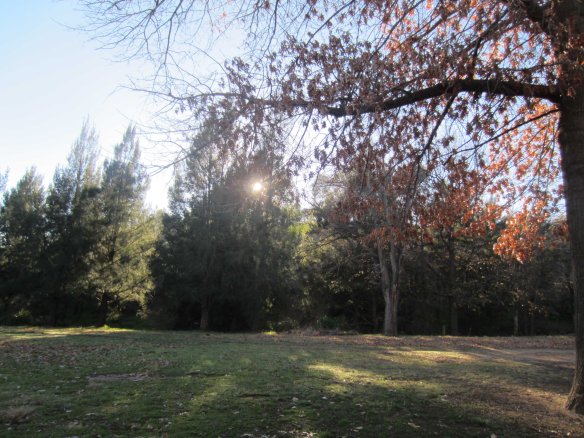
A view over the southern suburbs of Canberra. You can see why it is known as “the bush capital.”

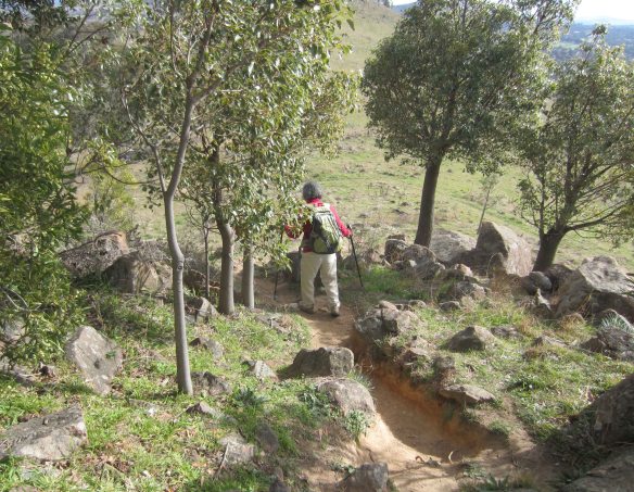
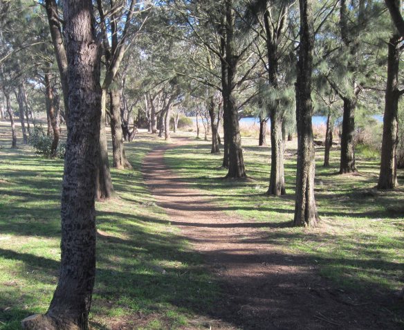
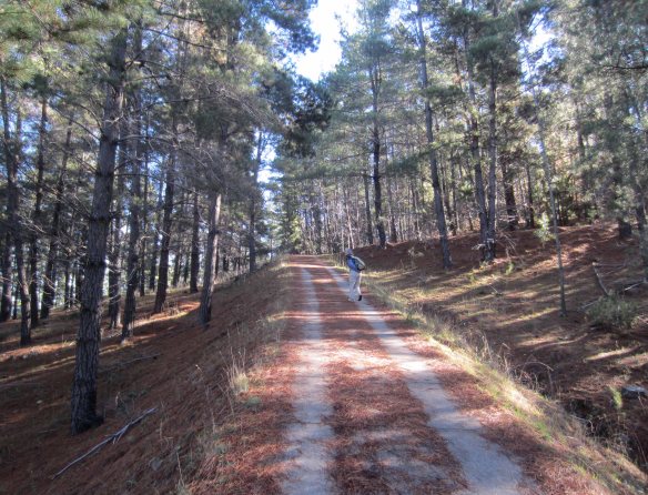
Walking paths like this, shared with cyclists and joggers, criss-cross the suburbs of Canberra.

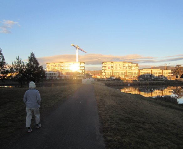
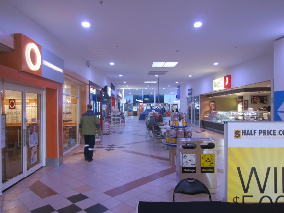
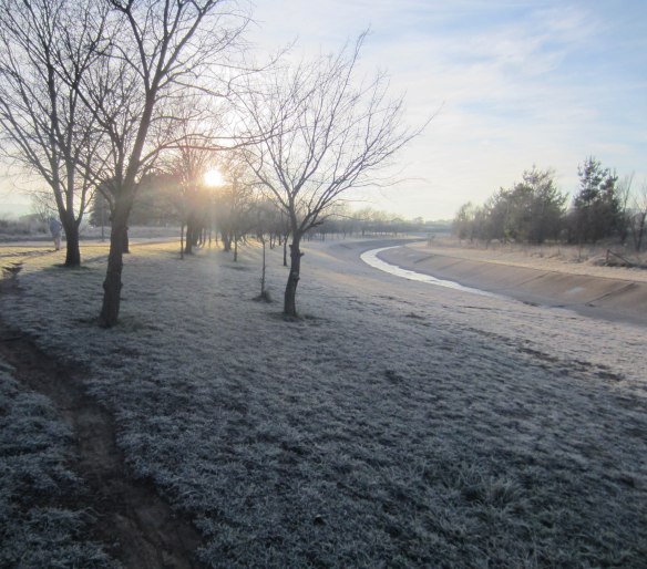
But wait… maybe my street is as interesting. Not as dramatic or sensational as Neighbours or Gran Torino, of course, but fascinating nevertheless. Even a short walk through the suburbs of Canberra – which is about as “suburban” as you can get – tells us a whole lot about the complexities of local society, even about the highs and lows of life in general. So come along with Emmy and me as we walk from our front door in Gowrie, Tuggeranong, to the Hyperdome shopping mall and back. In its own quiet way this walk twangs with social tension.

From home, our walk snakes through suburbs and parkland for about 17 kilometres. It takes us south through the sleepy streets of Monash, around Lake Tuggeranong, through the Tuggeranong Town Centre (better known to us as “lego-land”) to the Hyperdome, then back home through suburban parkland. It’s a walk we often do, and usually we knock it over in about four hours, including a generous stop for coffee and a big chocolate-topped caramel square in the Hyperdome shopping mall.

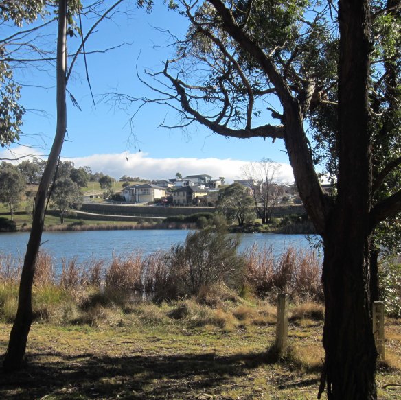
“Legoland”… the commercial centre of Tuggeranong, built in the 1980s, seen from across its adjacent, artificial lake.

Our first landmark, just 500 metres from home, is the Gowrie Primary School (http://www.gowrieps.act.edu.au/), a government school administered by the Department of Education and Training of the Australian Capital Territory. It has about 200 pupils and a total of 20 dedicated staff. The federal government’s My School web site (http://www.myschool.edu.au/) shows that, on the whole, the quality of Gowrie Primary School is good, though in some domains it is struggling to reach the national average by comparison with similar schools across the country.

In 2008 the federal government announced a “stimulus spending” program intended to buoy the economy in the face of the Global Financial Crisis. The money was splurged on education infrastructure – mostly buildings – in a program called Building the Education Revolution. It seems to have worked. As the economies of Europe, the US and many other countries were knee-capped Australia strolled away from the crisis pretty much unscathed. But there was criticism of BER, even ridicule. I had heard vaguely about this, but little did I know that just metres from my front door there was, in effect, a diorama that summed up the criticism beautifully.

Gowrie Primary copped two projects. The first was a multi-purpose building that included two new classrooms, a shared learning area plus community and student facilities. It cost 2.15 million smackeroos. Sounds expensive to me, but what do I know? At least it made some sense in educational terms. But the other project was more problematic. It was “new shade structures” over a small cluster of existing playground equipment. Translation: three fairly small curved iron roofs on stilts. And the cost? $124,000.

The Gowrie Primary School playground as it used to be…

… and $125,000 later, as it is now.

Why build an expensive roof over a few bits of play equipment? To protect children from the serious threat of sunshine, of course. But if a bit of sunshine is so dangerous what’s going to protect the fragile little darlings as they walk along unshaded footpaths? And play on soccer fields? And dig holes in their back yards? Or (the danger! the danger!) build sand castles on the beach in summer?

The playground project was unnecessary and outrageously overpriced. But worse, it was an investment in useless infrastructure at a time when teachers were on their knees begging for training to improve their classroom skills. $124,000 would have gone a very long way towards boosting learning outcomes and teacher morale at a school that is currently a bit below average. But for our politicians and economists and actuaries what was important was the necessity to spend, to “get the money out the door” as one of them said. And being simple-minded creatures, for them new buildings were easier to see and count than improved reading and maths.

Gowrie Primary is a capsule that represents what has happened at thousands of schools across Australia. Its “new shade structures” stands like a memorial to haste, waste and ruthless price gouging by construction companies.

But let’s move on. We step on to a “cycle path”, pad down a gentle slope, and suddenly we are at war. There is a sharp “ding!” behind us and a lycra-clad figure wearing a streamlined helmet and wrap-round sun glasses is bearing down on us at warp speed. Hastily we step off the path and bend away from the quick smack of air he leaves in his wake. “Four more!” comes a shout and four more hunched cyborgs with pumping thighs sweep past. Cautiously I look back, extend a leg over the path, stand on it cautiously, look around again, and resume walking. We survive the ambush, but somehow the pleasure of the walk has been tarnished.

Tilting into the corner, two cyclists bear down on us very fast.

I have to admit, though, that 90% of cyclists are cheerful, considerate and polite, sometimes embarrassingly polite. But the remaining 10% make your teeth grind. They seem to consist of two categories: frustrated Tour de France aspirants, and cycling ideologues. The former treat surburban paths as their personal velodrome. Sometimes they form peletons. They ride very fast. They hate using their brakes. You can’t talk to them, let alone reason with them… they’re too quick. A sweaty flash and a click of gears, and they’re gone. The second category can sometimes be downright nasty. They are pedal-power activists. You can’t reason with them either. For them, riding a bicycle is a statement of concern for the environment and good health. It is the way of the future. A crusade. Anyone who gets in their way – whether a motorist or a walker – is violating their rights and is an affront to their moral superiority.

For over a decade bicycle sales have boomed in Australia, far exceeding car sales. At the same time more and more people are taking up walking as a form of exercise and even (as in my case) a form of meditation. So far the two trends have managed to coexist on the increasingly clogged suburban artery-paths of Canberra. But it is an uneasy peace. At some point in the future someone is going to get injured, the two tribes will go to war, and they may have to be physically separated.

Here are a couple of news reports that illustrate the issue, one from Australia (http://city-north-news.whereilive.com.au/news/story/walkers-on-war-path-over-cyclists/) and another from the US (http://www.dnainfo.com/20100719/upper-west-side/cyclists-spar-with-dog-walkers-riverside-park).

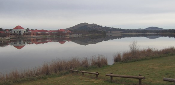
A trackside map of Lake Tuggeranong. Starting from the bottom right corner we normally walk anti-clockwise around the lake following the squiggly green line – a distance of 6.7 kilometres.

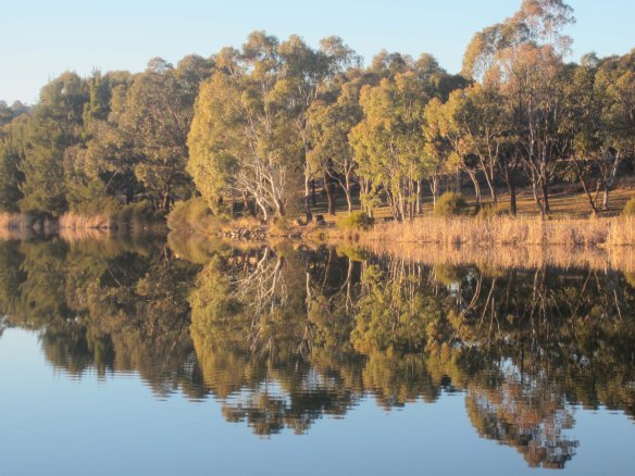
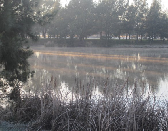
So… dodging cyclists we reach the tree-fringed waters of Lake Tuggeranong, about an hour into the walk. We turn right and head north along the eastern bank of the lake. (You can see a photo of Emmy walking this segment of the path above the title of this post at the very top of the page.) Like the other lakes of Canberra, Lake Tuggeranong is an artificial lake (you can see its dam on Google Earth at: 35°24’30.87″S, 149° 3’48.61″E). Perhaps this is why it is difficult to keep it clean. Under its tranquil surface the lake is badly polluted. There are four main kinds of pollutant: storm debris, algae, intrusive fish species and man-made rubbish.

Lake Tuggeranong can be dazzlingly beautiful…

… but close up, its beauty is stained by blue-green algae and other pollutants, a gift to the lake from human life-style and commerce.

When heavy rain thrashes the Canberra region (it doesn’t happen often, but when it does happen it can be biblical) it throws debris into the city’s lakes. Several streams feed into Lake Tuggeranong and the traps at their entry points get overwhelmed. Leaf debris, jagged branches, sewage and mud fill the lake. At other times, especially after long periods of dry weather, algae oozes through the water like green vomit. Contact with it can cause skin irritation, stomach infections and even bleeding in the liver. Like a pin suddenly jabbed into a bureaucratic buttock, algae panics hit the local government several times a year. Lakes are closed, signs erected, edicts issued, and warning fingers are wagged at citizens through the mass media.

But why do these outbreaks occur? Well, blue-green algae is a natural component of fresh-water and marine environments everywhere. The bloom feeds off phosphate compounds that are found naturally. But phosphates are also used in huge quantities on farmland, in household gardens and in some manufacturing processes. These chemicals leach into waterways and end up in Canberra’s lakes. They should be diluted or flushed away by the natural action of rainwater, but climate change has reduced rainfall (Canberra’s last drought – the longest in its history – lasted from 2001 to 2008), and when phosphate use keeps rising, algae blooms banquet on the man-made feast, growing fat and greasy.

There are solutions, of course, but they would cost more money than people are prepared to pay. And most people prefer not to be confronted with the less savoury consequences of their lifestyle choices and profit-spinning enterprises. Environmentalists will cry out for action, conservative governments, commercial interests and “economic rationalists” will resist action. And anyway, efforts to restore degraded rivers and lakes have not been very successful. So the problem will persist and almost certainly get worse until the situation becomes unbearable. Only then will something really decisive be done. (For a short TV report on the issue, see http://www.abc.net.au/news/2012-03-16/lakes-closed/3895324 ).

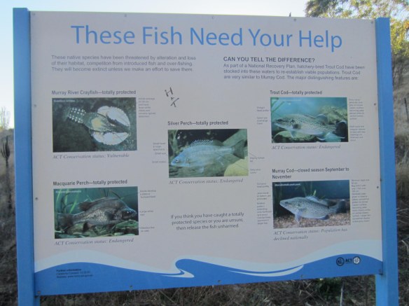
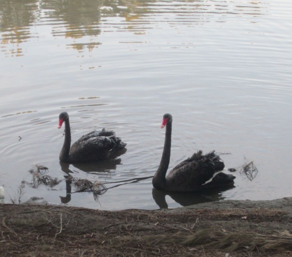
Perhaps it’s this nutrient-rich orgy that also sustains the non-native fish that have somehow got into the lake, and allows them to grow as big and fat as the blooms of algae. There are two species of foreign fish in particular that flourish: European carp and redfin.

According to Wikipedia, “in Australia, enormous anecdotal and mounting scientific evidence indicates introduced carp are the cause of permanent turbidity and loss of submergent vegetation in the Murray-Darling river system, with severe consequences for river ecosystems, water quality and native fish species. In Victoria, common carp has been declared as noxious fish species, the quantity a fisher can take is unlimited. In South Australia, it is an offence for this species to be released back to the wild. An Australian company converts common carp into plant fertilizer.” Redfin, also called European perch, likewise deplete stocks of native fish and cause turbidity.

The European carp, an abundant pest that takes food from the mouths of native fish and keeps the water of Canberra’s lakes clouded with mud. (Wikipedia image.)

Neither the European carp nor the redfin are considered good to eat. In Australia they are commonly seen as vermin and, by law, they must be killed when caught. In fact every year the Canberra Fishermen’s Club holds a day-long event called the Canberra Carp-Out in which anglers compete to take as much carp and redfin as they can from the city’s lakes, hoping this will free up the lakes for native fish to recover. Some hope. This year almost 1,000 entrants registered. They caught 1,113 “noxious fish” with a total weight of 1,481 kilograms (that’s over one kilogram per fish!). All were sent off to the Australian National University’s environment agency to be recycled into garden compost… an ignominious end for these innocent pests. Yet somehow they thrive. By next year they’ll be back more numerous than ever and the Carp-Out will be an even bigger event. Evidently the war on carp and redfin is not going to be won easily.

The turbid waters of Lake Tuggeranong also stink with rubbish, although as you walk the shores of the lake your stink-meter will go up and down depending on the time of year, the direction of the wind and the corner of the lake you are passing. Most often there will be no smell at all and not much to see. But around the next headland you will gulp and gag as a sour smell gets into your mouth. Trapped in the quiet waters of an inlet you will see milk cartons, plastic bags, beer cans, paper cups from McDonalds and KFC (both chains have branches on the lake shore), clothes, car tyres, plastic bottles, the occasional rusting supermarket trolley, and much more.

A rubbish trap in one of the streams that flow into Lake Tuggeranong. After rain, these traps fail to stop debris and rubbish from piling up in the lake.

On the annual Clean Up Australia Day hundreds of volunteers hold their noses, steady their stomachs, and fan out through Canberra to clear away a year’s deposit of detritus. In 2011 a total of 160 tonnes of gunk were collected in one day over the whole city, and many scores of these tonnes came out of the city’s three main lakes.

An Aboriginal ceremonial meeting place on the shores of Lake Tuggeranong.

Emmy and I have now reached an aboriginal meeting ground on the lake’s shore (35°24’31.19″S, 149° 4’10.46″E). Here we stop for a few minutes to draw breath and drink. We have covered a little over six kilometers. In my next post we’ll walk past a “Men’s Shed” just 500 metres ahead of us, tuck into some unhealthy food among the fatties of the Hyperdome, and look at two institutions of religious faith along the home stretch of our path.

Update: On May 24th 2012 Lake Burley Griffin in the centre of Canberra was closed by the National Capital Authority because of blue-green algae readings that were said to be 1000 times above safe levels and “potentially fatal.” A big water jet in the middle of the lake was turned off because of fears that it might spread a fine mist of algae laden water that would endanger the public. Read the full news report at: http://www.canberratimes.com.au/act-news/potentially-fatal-levels-of-bluegreen-algae-close-lake-20120524-1z86r.html#ixzz1vs9cbAiH

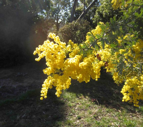
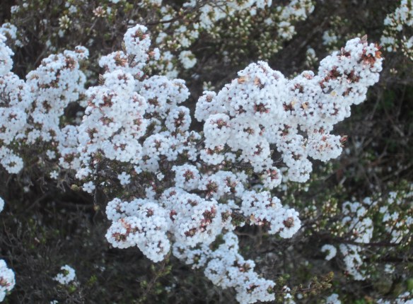
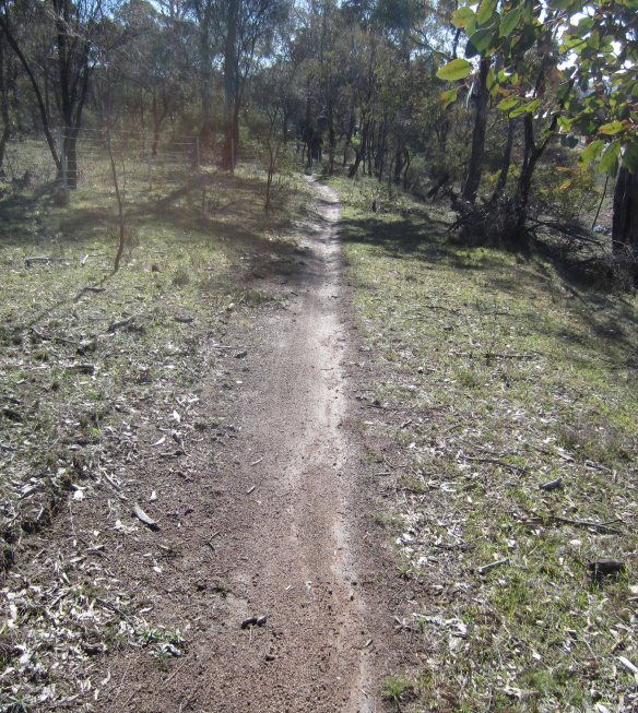
Refreshing greenery along the path from our home to the Hyperdome shopping mall.