Winter Walking in Canberra: A two-banana walk to Weston Creek

You can measure a walk in steps and kilometres. I have a Garmin Vivofit wrist band that does this, as well as a Runkeeper GPS tracker app on my mobile phone. These devices are pretty accurate. They tell me that this morning Emmy and I walked 16,247 steps over a distance of 12.67 kilometres. But somehow this is not precise enough for me. I find it more scientific to measure a walk in terms of bananas consumed and bottles of Diet Coke drunk. By this measure today’s walk was a two-banana, one-Coke walk. It took us from home along Lake Tuggeranong through the parkland of Kambah and the suburbs of Weston Creek to Cooleman Court shopping centre.

Two_bananas_map(b)

Our route from Lake Tuggeranong to Weston Creek. It took a little over three hours.

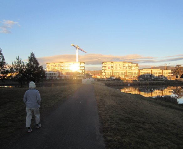
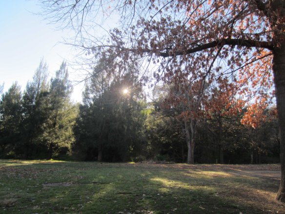
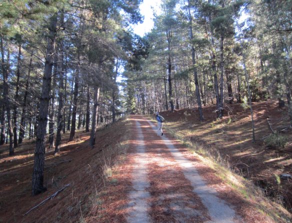
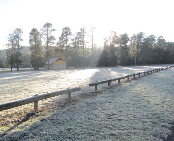
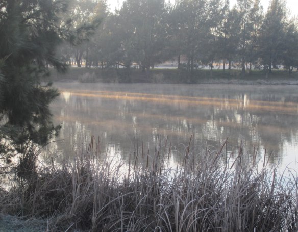
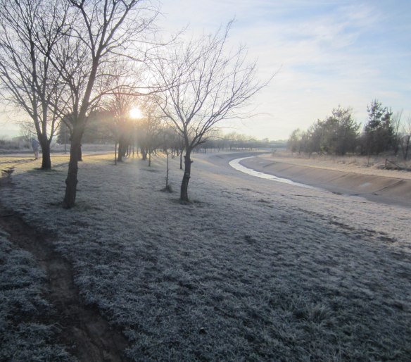
As always we were on the road at around 7.30 am. The temperature was minus-2 degrees, the sky cloudless, the air rigidly still. Have you ever noticed how slowly the sun rises in winter? It lays cold planks of sunlight across the landscape that somehow don’t move. It refuses to rise above the tree-tops. It is constantly sparkling among branches and flashing between tree trunks as you walk through parkland. It took us three hours to reach Weston Creek and as we approached Cooleman Court the sun was still yawning and stretching out along the ridge of the shopping centre’s roof.

Two_bananas_shadow_over_lake

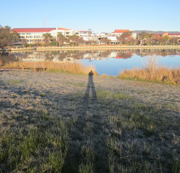
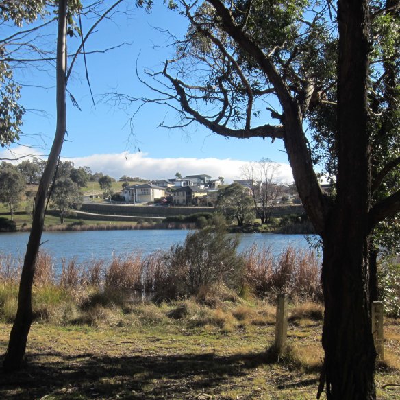
My plastic-man shadow points across Lake Tuggeranong to the Tuggeranong town centre.

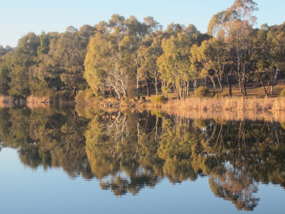
Lake Tuggeranong is oriented more or less north-south. From the familiar path along the east shore we looked down the rolled-out length of our shadows across the water to Tuggeranong College and the Hyperdome Mall. Their tranquil upside-down images were sliced by the scalpel of a rowing boat as a lone oarsman replayed last night’s Olympic races on the smokey water.

Two_bananas_ibis_cranes

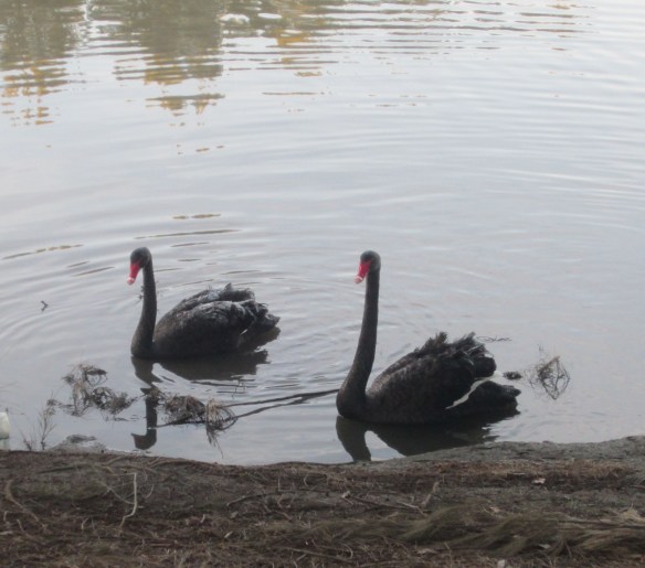
Ibis cranes enjoy the morning sun on the shore of Lake Tuggeranong.

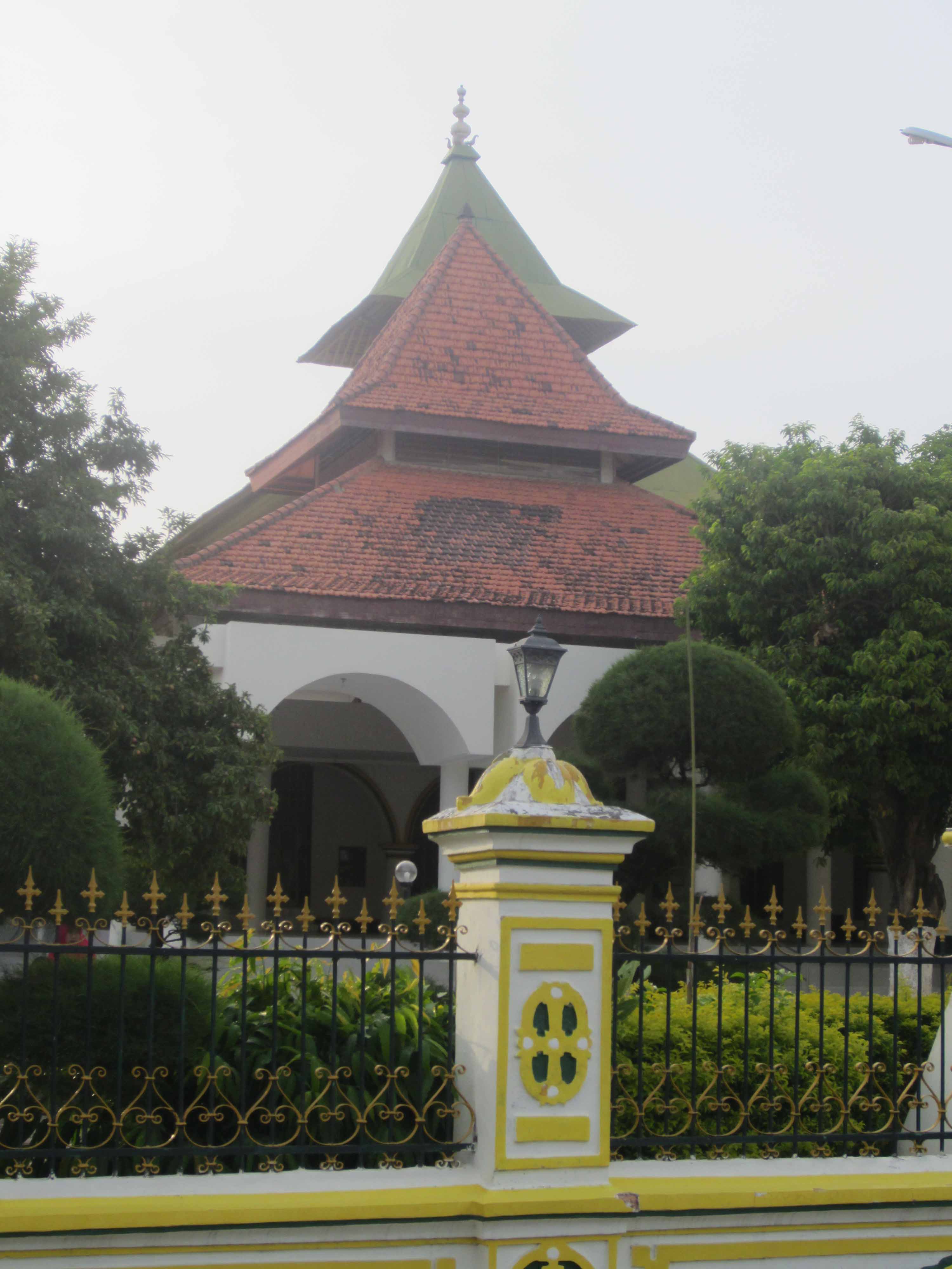
Just off the north end of the lake we came upon a Lao Buddhist social centre, the Wat Lao Buddhanimit, a small but exotic-looking building with an orange-tiled Lao-style roof and brick fence posts topped with lotus buds. Buddha was reclining in the yard looking into the frosty sun and the grey silhouettes of Australian gum trees. He looked pretty much at home.

Two_bananas_Lao_Buddhist_centre

The Lao Buddhist temple and community centre.

Two_bananas_Buddha_&_rising_sun

Buddha wakes up to the icy sunlight of a winter morning at the Lao community centre.

Further on I paused to grind my teeth as we passed a children’s play area. A sign warned that the skate bowl was “inherently dangerous and may result in injury to the person and/or property loss or damage.” Regular readers of this blog will have noticed I have little patience with the excesses of the “risk management” industry and their groupies in insurance companies, the legal profession and the crowded ranks of gormless parents (see for example: https://walktenthousandmiles.net/2012/04/16/review-across-europe-alone-on-foot-aged-eighteen/ ). By nagging us incessantly about risk avoidance – even the tiny risks of a playground – they are doing damage to the resilience of Australian children. And it’s not just children. My special bête noire is the warning screen that precedes many television programs, programs that some anonymous individual thinks may put you at risk of being discomforted by reality. You’ve seen them.

“The following program has content that may concern some viewers.”

(This is not a sarcastic exaggeration… it is quoted here verbatim from several ABC television programs.) Last time I saw this dumb announcement I almost threw a shoe at the TV set… but I thought better of it and threw a sock instead. The TV was not damaged and I felt a little calmer.

Two_bananas_warning_sign

Watch out kids! Death awaits you in this playground.

Not far from the mortally dangerous children’s playground we came to the battered remains of a woolshed. Originally built in the late 19th century it has been partially rescued and turned into a picnic shelter. It is a low-key but exotic reminder that Canberra has sprawled across what was once productive farmland. Right beside the woolshed lies a community garden. Crusted with frost, its many small plots were full of kale, cabbage, broccoli, silver beet and a multitude of little-known vegetables like Japanese komatsuna, daikon and bekana cabbage. The garden is a tribute to the determination of local people, many of them recent migrants, to fight back against the urban neutering of farmland fertility. As they turn the soil they have found old horseshoes, and the metal parts of horse-drawn ploughs and carts.

Two_bananas_woolshed

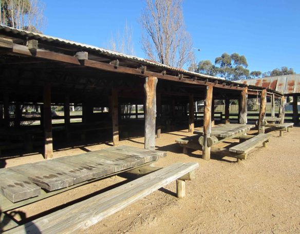
The remains of a 19th century woolshed now a picnic shelter popular in summer…

Two_bananas_Kambah_community_garden(b)

… and the adjacent community garden where horseshoes and metal parts of horse-drawn ploughs and carts have been dug up.

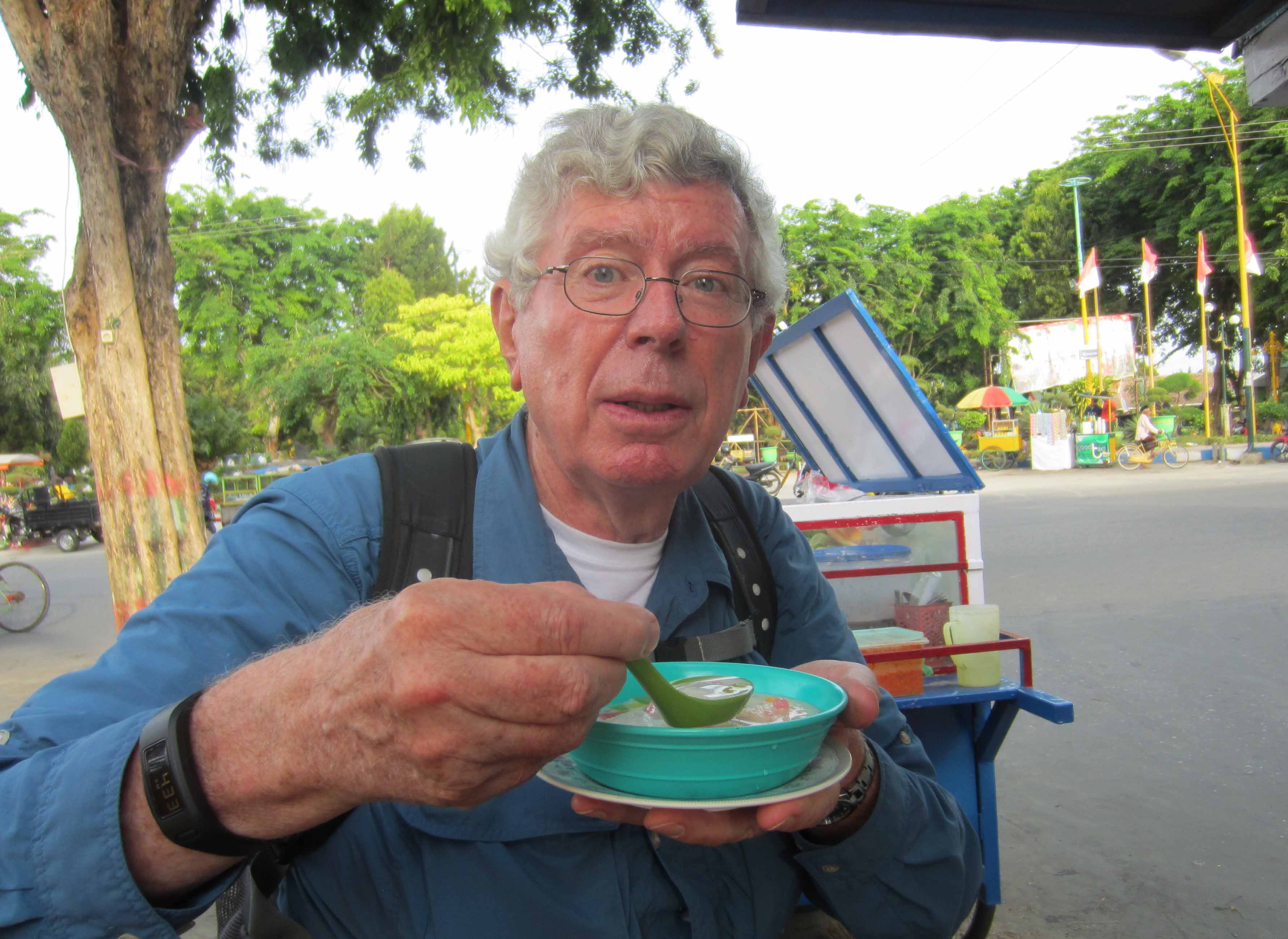
A little over seven kilometres into the walk, across Drakeford Drive from the Kambah Shopping Village, we stopped for a rest at the side of a football field. I ate the first of my bananas and sipped water. Then it was on to the nearby intersection where we would strike left up Namatjira Drive towards Weston Creek. On the other side of the intersection I saw a large box-like building with the word Eternity staring in large letters from its featureless, grey wall. From a distance I thought it might be a factory, perhaps manufacturing washing powder or perfume. But it is in fact a church in the pentecostal-charismatic mould. According to the church’s web site “It has been said many times that Canberra is a city without a soul. Our goal is to change this.” Sounds noble and generous, doesn’t it, especially when you don’t bother to define the word “soul.”

Two_bananas_rest_break

Time for a quick snack and drink.

Two_bananas_Eternity_beckons

A grim-looking Eternity beckons near the intersection of Sulwood Drive and the Tuggeranong Parkway. But the location is perfect… the intersection is an accident hot-spot.

Between 1932 and 1967 a former soldier, petty criminal, alcoholic and late-life convert to Christianity by the name of Arthur Stace wandered the streets of Sydney by night chalking “Eternity” onto footpaths and walls. It is estimated he wrote the word more than half a million times. The people of Sydney – whose lives revolve around making money, shopping, sport, drinking and loafing at the beach – eventually noticed it and (characteristically) registered it as a trademark. Today the word has acquired mantra-like status in some corners of Australia’s Christian community. Canberra’s Eternity Church used to be known as the Parkway Church (named after the adjacent highway) but a few years back it changed its name, choosing to surf on the unique history and spooky overtones of “Eternity.” The church is popular, so it was a good marketing move.

Two_bananas_wattle_blooms

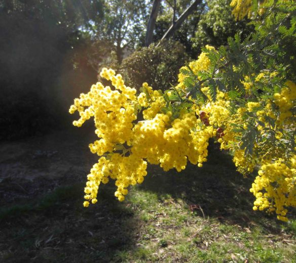
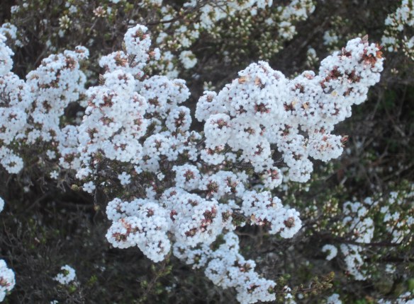
Wattle on fire, an early sign of spring.

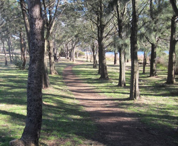
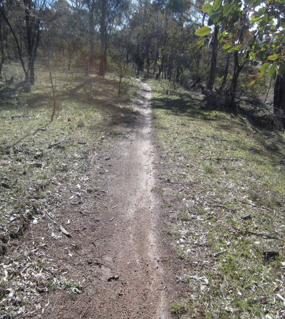
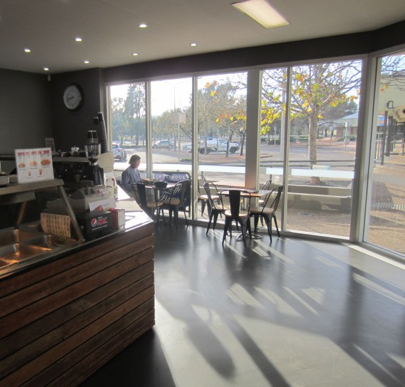
The last leg of the walk took us through the leafy suburbs of Chapman and Stirling down to Hindmarsh Drive and across to the Cooleman Court shopping centre. There we enjoyed a leisurely drink before catching a bus to Woden, then another south to Tuggeranong and a final walk of two kilometres back home. I felt quietly pleased. Sure, it was only a two-banana walk, but it had taken us through varied environments: suburban footpaths, beautiful tree-filled parks, lakeside pathways, farmland, even a modestly testing hill.

And at the end of the walk there were no distress signals of any kind from any quarter of my ageing body.

Two_bananas_Coke_at_Cooleman

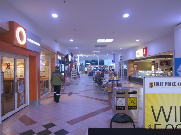
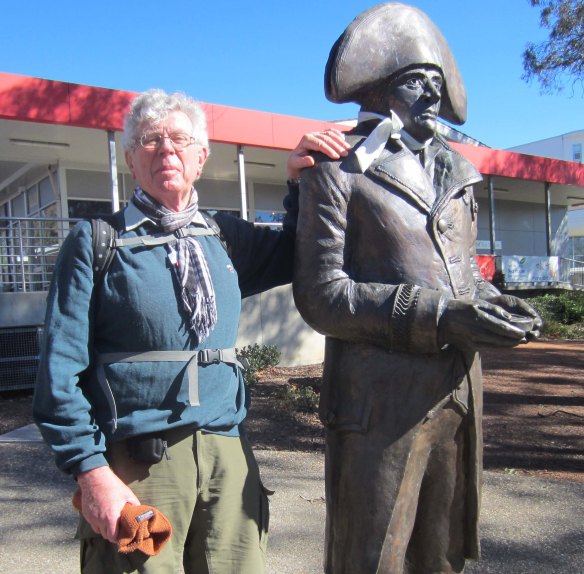
At Cooleman Court shopping centre I measure the distance we have travelled.


Advertisement

Winter Walking in Canberra: A bush track in the south

The Murrumbidgee River Corridor runs along the western edge of Tuggeranong in Canberra’s southern suburbs. The bush reserves along the river host several picturesque walking tracks. This morning Emmy and I walked the track that runs south from Pine Island Reserve along the banks of the river to Point Hut Crossing. We rested in a small quiet park there before returning to Tuggeranong around a loop that passes through grassy farmland. We covered just under 12 km in three hours. For this post, I’ll let the pictures do the talking.

Tracks_map

The bottom end of the loop, at Point Hut Crossing, is not far from the Lanyon Market Place shopping centre on Tharwa Drive.


Tracks_South_Quay_apartments

We left home shortly after 7 a.m. and crossed Lake Tuggeranong as the rising sun bounced off the newly completed stage one of the Southquay apartments.


Tracks_Stranger_Weir

Stranger Pond was dead still (and cold).


Tracks_warning_sign1

Canberra’s bureaucrats are wagging their fingers in your face as you venture into the mortal danger of suburban bushland.


Tracks_wildflowers2

August 1st, but already beautiful wildflowers are blooming in profusion.


Tracks_fish_sign

Native fish are under threat in the Murrumbidgee. If you catch one “release the fish unharmed.”


Tracks_Point_Hut_park

Cold but beautiful sunlight creeps into Point Hut Crossing park.


Tracks_gravel_path

We’re heading back through empty farmland.


Tracks_kangaroo

A lone kangaroo raises its head from breakfast. This (believe it or not) is an urban kangaroo… we’re still inside the boundaries of Canberra city!


Tracks_picturesque_walking

Picturesque walking as we approach the suburbs of Tuggeranong.


Tracks_suburban_houses_approach

Suburbia laps down to the banks of Stranger Pond…


Tracks_building_construction_site

…and back in Tuggeranong we pass through a construction site. Is this the future of the bush tracks we have just enjoyed?


Winter Walking in Canberra: The Great Lake-to-Lake Trek

It was (would you believe) my birthday present to myself. What on earth was I thinking?

Emmy and I would walk from our home near Lake Tuggeranong in the southern suburbs of Canberra, to Lake Burley Griffin in the centre of the city. The route I had figured out meandered through nature reserves and suburban streets, side-swiping Parliament House before crossing Lake Burley Griffin along Commonwealth Avenue. We would be walking over a variety of surfaces, from streetside footpaths, to bicycle paths, to muddy tracks, to gravel access roads in reserves and parks. It was mostly fairly flat, but Waniassa Hills would set our jugulars pulsing. There were just two clusters of shops along the route, Erindale and Red Hill, so we decided to carry all our water and food with us.

Lake-to-Lake_early_morning_Erindale_Drive

Heading north along Erindale Drive at 8 a.m.

When I worked out the route I didn’t think too much about the distance. Big mistake. As the crow flies it is about sixteen kilometers from our home to the centre of Canberra, a manageable distance for two less-than-fully-fit elderly walkers. But my meandering route actually totalled 26.4 kilometers. I only found this out when I checked my GPS thingy as we dragged ourselves aching and grimacing into our terminus at the city centre bus station.

Lake-to-Lake_map

Our route. Highlights… Erindale Centre (3 km); great views from the top of Waniassa Hills (7 km); Isaacs Pines (9-11 km); more great views over Woden Valley (12 km); kangaroos (14 km); lunch (16 km); La Perouse (18 km); Parliament House (22 km); croquet! (23 km); crossing Lake Burley Griffin (24 km); catching a bus home (26 km).

Six hours previously, at 7.50 am, we had stepped into Canberra’s morning chill full of naïve energy. The temperature was around one degree. The sky was ivory white with a faint touch of blue and completely clear. There was no wind. Perfect conditions for walking really. But the sun came at us like a trumpet blast, dazzlingly bright and right in our eyes. It left a zebra-like stamp on the streets and parkland of the southern suburbs: stripes of white frost alternating with spindly black shadows from leafless trees.

Our first stop was the Erindale Shopping Centre where we sat down for a few minutes in the arcade to warm up. I have mixed feelings about the Erindale Centre. On the one hand it is so tacky and bland that my heart sinks whenever I walk into it (we often do our shopping there). On the other hand it is not ashamed of its commercially-driven ugliness. The people there rise so effortlessly above it that you forget the surrounds. There’s the Chinese gentleman who patrols the tubs of deep-fry fat in the Erindale Takeaway. He never fails to talk Tai Chi with me, and gives me a 20 cent discount on my weekly rehydration medication (a bottle of Diet Coke). His associate, a diminutive grey-haired lady, is addicted to ocean cruises. She talks modestly of her adventures. Travelling on her own she has seen far more of the world than I have: Alaska, the Caribbean, the Mediterranean and Germany, Fiji and New Caledonia. And after cruising the fjords of Alaska she returned to her regular job shovelling glistening potato chips into paper bags with a bright smile and no hint of regret.

Lake-to-Lake_Erindale_Centre_interior

The warm but functional and bland interior of the Erindale Shopping Centre, but outside…

Lake-to-Lake_Erindale_Centre_exterior

… where for decades there was a big brick wall, now there is a colourful mural depicting Tuggeranong’s “timeline”.

We left the Erindale Centre and walked along cycle paths through Gowrie, turning left and uphill into Fadden. Among the grey gum trees an army of cockatoos was at war. It was a serious civil war with dive-bombing and ambushes and hand-to-hand screeching. Every morning around dawn, and again at dusk, the same war breaks out. A bit like Australia’s election cycle. The middle of the day is truce time.

About one and a half hours into the walk – seven kilometers – we found a roadside bench high up in Fadden Heights and stripped off our outer layer of clothing. The temperature was still no more than five degrees but four layers were now too many. A quick bite of Danish pastry and a swig of water and we headed up the steep slope into Waniassa Hills. We were completely alone, only a few kangaroos stared at us in shock as we laboured upwards puffing steam from our mouths.

Lake-to-Lake_Isaacs_Pines

The morning sun manages to penetrate the cool shadows of Isaacs Pines.

Then, like passengers locked in a roller-coaster, we swooped down across Long Gully Road into the pine forest of Isaacs. Isaacs Ridge cast a cold morning shadow over its western slopes and amid the thick stands of trees the temperature dropped. But the gravel path was flat and wide and we walked with new enthusiasm. A couple of kookaburras laughed at us as we passed, but we were not discouraged. We laughed back. At the northern end of the forest we paused to take in the vista over Woden town centre and beyond, through thirty or forty kilometres of crystal-bright winter air, to the snow-flecked Brindabella ranges.

Lake-to-Lake_kangaroos1

Beautifully camouflaged grey kangaroos settling in for their post-breakfast snooze.

The path took us past the back fences of O’Malley’s well-heeled diplomatic residences before it swerved right and headed into the native bushland of Mount Mugga Mugga Nature Reserve. For two or three kilometres the path became a narrow track. We laboured around rocks and over mini-swamps through straggly stands of native bush before dropping down to the edge of Mugga Lane, the twisting road that connects Hindmarsh Drive with the Mugga Lane rubbish dump and the Monaro Highway.

Lake-to-Lake_bush_path

In Mount Mugga Mugga Nature Reserve walkers of the Great Lake-to-Lake Trek have to hobble along a narrow rut that (after last week’s rain) was still muddy in places.

Here, at twelve noon, four hours and exactly sixteen kilometers into the walk, we stopped for lunch. Emmy bit delicately into a wholemeal roll sprinkled with pumpkin seeds and filled with an austere mixture of tuna and salad. I wolfed down a huge refined-flour cheese roll stuffed with oily fish and bacon. My God it was delicious!

We crossed Hindmarsh Drive and walked into the suburb of Red Hill. At the Red Hill shops I stopped briefly before the bronze statue of La Perouse, or to allow him his full name, Jean François de Galaup, comte de Lapérouse. He led a French expedition of discovery to the south Pacific, arriving at Botany Bay almost simultaneously with Arthur Phillip’s First Fleet of English settlers in 1788. La Perouse visited many islands of the south Pacific before disappearing at sea some time in 1788. He is commemorated in the name of the street on which his statue stands: La Perouse Street.

Lake-to-Lake_with_Laperouse2

He’s got a compass in his hands, I’ve got a GPS thingy in my pocket. We’re mates.

La Perouse Street took us to the Red Hill Nature Reserve and two kilometres of easy walking along a dirt path. As we turned into broad, tree-filled Melbourne Avenue we could see the flagpole of Parliament House ahead of us. We were now in the home straight, or so we thought, but maybe it was wishful thinking. Aches and pains were starting to taunt us – a little niggle in the left thigh joint, a few tentative distress signals from the ball of the right foot, discomfort in the shoulder where the strap of my backpack was digging in. There was an ominous throb in Emmy’s right knee. We wanted the walk to end, but… when you walk there’s no turning back, no wimping out. We still had five kilometers to go.

We skirted Parliament House but didn’t spend too much time admiring it. Every time we paused to look we were almost skittled by Parliament House functionaries, escapees from inside the building out for their lunchtime jog. Some of them – women as well as men – were running quite fast, looks of desperation carved into their faces.

Lake-to-Lake_croquet

Slow down… this is croquet.

It was downhill to Commonwealth Avenue where a bizarre scene greeted us. Just below Australia’s Parliament house, next to the “heritage” 1930s Canberra Hotel, people were playing the genteel game of croquet on a carpet-flat grass square. A croquet mallet has a straight, long, handle like the handle of a golf iron, but at the bottom it plugs into a heavy block of wood. You stand with the mallet hanging in front of you, swing it back between your legs, and whack a heavy ceramic ball about the size of a grapefruit. The ball has to pass through a small narrow hurdle. It looks bizarre, but I guess it’s no more bizarre than any other sport. At the very least it is slow, and that gives it huge rarity value. But slowness is under existential threat, even in Canberra, so how can we ensure the croquet green doesn’t fall victim to the hyper-active victims of “development first” syndrome? Canberrans love their museums… so maybe it can become a central exhibit in a Museum of Slowness. What do you think?

And now we were crossing the Commonwealth Avenue bridge over the glittering expanse of Lake Burley Griffin. A cold afternoon wind was blowing off the lake pushing foam into the reeds at its edge. Then into the city centre and, with sudden eagerness, we leaped straight onto an express bus heading south to Tuggeranong and home.

Lake-to-Lake_wind_on_Commonwealth_bridge

A cold mid-afternoon wind whips at Emmy’s hair as we cross Lake Burley Griffin and head into the centre of Canberra.

After a day of walking I slept non-stop for almost eight hours (unusual for an old person). And the following morning, the payoff. All the aches and niggles had ebbed away revealing the mild “high” that comes from extended physical exertion. We both felt good.

“Let’s do it again,” said Emmy. “Today!”

But after 35,000 steps the previous day (according to my Garmin Vivofit wristband) for me that was a step too far.


Winter Walking in Canberra: Ice Age Tuggeranong

If you happen to be in Canberra and you see two elderly people going out for an early morning walk determined to cover twelve kilometres in temperatures around minus five degrees, please, please, please…. stop them! If necessary, call the people in white coats.

Tuggeranong_Ice_Age_sunlight_on_frost

Frosty parkland on the path to Chisholm

Emmy and I left home at half past seven amid a white-out colder than the heart of an immigration minister. The grass of Tuggeranong’s parkland crunched under our feet. Trackside puddles were frozen solid, criss-crossed with stalks of grass trapped in the ice. Lake Tuggeranong lay flat and dead still. A few orange bars of light from the rising sun stretched across the water. They drew wisps of frigid steam from the lake. It was like another planet: cold, still, grey, completely deserted.

Tuggeranong_Ice_Age_sunlight_on_lake

The first streaks of morning sunlight raise steam on Lake Tuggeranong.

Tuggeranong_Ice_Age_swans

A couple of Lake Tuggeranong’s swans with a white crust of frost on their plumage.

We were heading for Chisholm shopping centre about six kilometres away. Most of the asphalt path ran alongside a floodway – a kind of broad concrete channel designed to carry rain water out of the suburbs and into Lake Tuggeranong when it rains. Good idea, except for one small fact: it hardly ever rains in Canberra, at least not heavily. For most of the year the channel is dry. Kids on skateboards swoop up and down its sloping sides, keeping a wary eye out for Canberra’s guardians of child safety.

Tuggeranong_Ice_Age_floodway

The floodway (with water in it… we had good rain a week ago.)

Tuggeranong_Ice_Age_Quinn(b)

Cold? Nah!

But this morning there were no defiant shouts of fun. We walked like explorers in the remains of an abandoned civilisation, or time-travellers thrown back into a prehistoric era. I was reminded of Alan Weisman’s remarkable book The World Without Us in which he visits places abandoned by human inhabitants and imagines what will become of our planet if (better… when) humankind becomes extinct. If you like our planet, it’s not all bad news. Gaia will endure. Canberra on a winter morning is proof of it.

After an austere cup of tea in a deliciously warm takeaway at Chisholm, with chips, pizzas and burgers steaming in stainless steel pans in the display counter, around 9.00 am we headed home. At the Gowrie playing fields we stopped for a few minutes to watch children playing footy with the intensity that only children have, while quiet groups of parents stood on the sidelines hugging themselves against the cold. Further on, cars were filling the broad parking area of the C3 Church. The faithful jumped from the warmth of their cars and sprinted for the warmth of the church. The warm inner glow and the warm outer glow go together.

Tuggeranong_Ice_Age_Chisholm_centre

At last, civilisation! (Correction… Chisholm shopping centre.)

Tuggeranong_Ice_Age_Chisholm_takeaway

A quiet hot drink in a Chisholm takeaway. Hmmm… smell those chips!

That goes for walkers too. We like our comforts, though we have to get used to deferring them. It was 10.30 when we arrived home and we rushed to the temperature control button on the gas heating system. After three hours and 12.5 kilometres it was a relief to pull off our insulated beanies and insulated gloves. Soon the kettle was boiling and we cupped our hands around hot drinks.

Tuggeranong_Ice_Age_Sunday_morning_footy

Learning to be Australian. Sunday morning footy (rugby league) at the Gowrie playing fields.


A short walk through the streets of Sumenep

Two friends head home after mid afternoon prayers at Sumenep's Grand Mosque

Two friends head home after mid afternoon prayers at Sumenep’s Grand Mosque

The plan was to walk seven kilometres through the streets of Sumenep, leaving my hotel room in the mid afternoon and returning at nightfall as I had done two weeks earlier in Jogjakarta (see “A twenty-first century walk along Jogjakarta’s ancient axis”). It was a very modest target, or so I thought. But when I stepped into Trunojoyo Street the plan unravelled immediately. In the end I managed just three kilometres in three hours.

Before I tell you why, let me step back a little and paint some context. If you squint and look hard at a map of Indonesia you might see Sumenep (pronounced /SOO.m’n’p/) at the eastern end of Madura, the flat, dry island that stretches out snoozing in the tropical sun off the north coast of east Java. Indonesia’s economic boom has been looking in another direction and hasn’t noticed Sumenep yet. Its economy still relies mostly on fishing, the production of sea salt, some cattle farming and small orchards. Pilgrims visiting the royal burial ground of Asta Tinggi on the outskirts of town, and the nearby holy tomb of Sayyid Yusuf, also contribute. A bit of revenue comes from support operations for oil drilling in the Kangean islands further east.

There are a few new cars and motorbikes in the streets, of course, but unemployment – or more accurately, gross under-employment – remains endemic. Consumer goods that are everyday items elsewhere in Indonesia may be luxuries in Sumenep. I went into a supermarket looking for chocolate (my weakness). I couldn’t find any on the shelves but staff led me to a locked, glass-panelled cabinet. Behind the glass there were KitKat bars, and Indonesia’s Silver Queen chocolate bars, even a lone packet of Australian TimTams. But no-one could locate the key so I had to peer longingly, swallow hard, and move on.

Burn marks left by cigarette butts n the table in my hotel room. I'm surprised the hotel hasn't burned down.

Burn marks left by cigarette butts on the table in my hotel room. I’m surprised the hotel hasn’t burned down.

I stayed at the Wijaya I Hotel, which was once Sumenep’s premiere hotel. It may still be. (You’ll find it mentioned in Lonely Planet guides). My VIP room cost Rp.135,000 a night, around $10.00 US. The hotel was a fairly typical small town hotel, but even by small-town standards the label “VIP” was way over-the-top for the quality of the room I was given. It had no towel or soap. It had no hot water or toilet paper. Its Formica-topped table was covered in black welts from cigarette butts that had burned out along its edge over many years. But I don’t want to sound sour, so let me be even-handed. It did have an air-conditioner (with the reassuring buzz of a diesel tractor), a small table-top fridge (that kept my drinks nice and warm), and a tiny TV set (with exotically snowy pictures from its three channels). And when I moved in I was given an enthusiastic welcome by a family of mosquitoes.

The bathroom in my VIP hotel room. You flush the toilet by bailing water into it from the adjacent tub.

The bathroom in my “VIP” hotel room. You flush the toilet by bailing water into it from the adjacent tub.

I have to confess that despite these comforts I was quite pleased to leave the room and stride out into the mid afternoon heat. But in the hard streets of Sumenep I was tripped up by a problem that sabotaged my grand walking plan. The people were much too friendly… in fact so spontaneously hospitable and curious that my progress slowed to a crawl. Again and again I was waylaid and invited to chat, and the chat always included the compulsory ceremony of group photographs using mobile phones.

A large black akik opal ring, typical of the rings currently fashionable (for men) in Indonesia.

A large black akik opal ring, typical of the rings currently fashionable (for men) in Indonesia.

My first stop was about a hundred metres from the hotel. I walked past a street side workshop where an artisan was squatting on the footpath trimming coloured stones (akik) with a small circular saw. Beside him a display counter was loaded with opal-stone rings. Customers could choose a raw stone and have it shaped, polished and fitted to their preference, or they could choose a ready-made ring. There is something of a mania for akik rings in Indonesia at the moment. They are especially popular with men who believe they confer protection and special powers on the wearer.

A tray of akik rings on sale in Sumenep.

A tray of akik rings on sale in Sumenep.

Surprisingly, the young akik salesman, Dayat, didn’t want to sell me a ring. He wanted to talk religion. Madura is one of the most strongly Islamic regions of Indonesia. Its brand of Islam is conservative and closely bound up with the power of traditional religious leaders called kyai who rule with iron authority over mosques, religious schools and social life. On the two nights of my stay in Sumenep I was blasted out of bed at 3.30 in the morning by an hour of high-decibel dzikr chants and sholawat songs hammering on the doors and windows of the neighbourhood from loudspeakers in the local mosque. As far as I could tell the neighbourhood slept sweetly through the half-musical cacophony, but being unused to it, I couldn’t. Nevertheless, as my head cleared and I relaxed into the rhythms of the incantations, I felt – as I always do – a powerful affection for the music of Islam. It is an ambience as public, as comforting and as beautiful (yes… beautiful, even when distorted by screeching, tinny, pre-dawn loudspeakers) as Islamic architecture, dress, food, etiquette, calligraphy, decoration etc.

Dayat, the youthful akik salesman, turned out to be an amateur sociologist and theologian. He stumbled into an apology for the tarnished reputation of Islam.

“Some people say the Bali bombers and other Muslim terrorists are not real Muslims, because they act contrary to the peaceful tenets of our religion. But Islam is a community and extremists have come from that community, so they are Muslims.”

He looked at me with agonised earnestness.

“As a Muslim I am ashamed of the reputation my faith has acquired for indiscriminate violence (kekerasan membabibuta was the phrase he used). I’m truly sorry.”

Inwardly I thought Dayat was being much too tough on himself and his religious community. Much (not all… but much) of the “indiscriminate violence” he was apologising for was frustrated, blind retaliation for innumerable instances of equally indiscriminate violence visited on Muslims in many parts of the globe by the ruthless forces of Euro-American power. This doesn’t excuse indiscriminate, violent retaliation, of course, but it helps us to understand it without having to put up with the gormless rhetoric of moral outrage and cultural superiority that marks so much discussion of “terrorism” in Europe, America and Australia. Unfortunately Dayat had adopted some of the premises of this rhetoric.

With Dayat, the akik salesman who felt ashamed of the violence committed in the name of Islam.

With Dayat, the akik salesman who felt ashamed of the violence committed in the name of Islam.

I took my leave and walked on towards Sumenep’s Grand Mosque in the centre of town. Built in the late eighteenth century with the tiered, pyramid-shaped roof characteristic of Indonesia’s pre-modern mosques it is fronted by a massive, multi-level gateway painted in an attractive combination of white and bright yellow. In front of the gate I fell into conversation with two young women, visitors from Pamekasan about 50 kilometres away in central Madura. Rennie, aged around 25, was wearing a full length black shift with her head swathed in a close-fitting, black hijab scarf. She radiated a forbidding aura of nun-like severity. Her younger friend Ita was also dressed in irreproachable Islamic style but her clothes were more colourful, even a bit trendy. Both were under the watchful guardianship of Ita’s older brother.

Sumenep's Grand Mosque with its traditional pyramid shaped, tiered roof.

Sumenep’s Grand Mosque with its traditional pyramid shaped, tiered roof.

They wanted to take a photograph of the tall, grey-haired foreigner doggedly plodding the streets of Sumenep with a rucksack on his back. They used their mobile phones, of course. When I suggested a reciprocal photo on my camera, Rennie glanced around nervously and declined, presumably out of religiously inspired modesty. But Ita had no such scruples. She handed my camera to her brother and simply commanded him to take a photograph of her and me. When Rennie saw the image her resistance evaporated and she solemnly but very willingly joined us. Moments later, looking at the images, she even let out a delighted laugh, although her chaperone was frowning.

I pose with Ita (left) and Rennie (right) in front of the big entry gate leading to the Grand Mosque.

I pose with Ita (left) and Rennie (right) in front of the big entry gate leading to the Grand Mosque.

Religious bigots take note. If you allow smart-phone technology and social media into the fortress of your ideology, sooner or later they will escape your control and bite you where it hurts. Eventually (though not always immediately) new media will subvert your messages. As Marshall McLuhan – the Canadian pioneer of media studies – famously said “The medium is the message.” Mobile phones, their cameras, their photos and Facebook are not the ultimate as tools of female emancipation, but for many women they are an unstoppable beginning.

It's got everything. Pak Sariman's iced fruit confection, just Rp.5,000.

It’s got everything. Pak Saniman’s iced fruit confection, just Rp.5,000.

I was feeling thirsty and noticed a drinks stand in a side street beside the mosque. I sat down behind it on a rough bamboo bench. Pak Saniman, the proprietor, picked up a dessert bowl and with a few deft flourishes of a ladle lifted diced pineapple, mango, avocado, water melon and jackfruit from a colourful row of fat jars. This was followed by some squares of sweet bread and a psychedelic landslide of green rice-flour noodles. Cloudy sweet syrup was poured in and diluted with a bit of coconut milk. To complete the concoction pebbles of ice were added. All this cost Rp.5,000, about 30 US cents. Pak Saniman had been at his stand since nine o’clock in the morning. It was now around 5.00 pm. As I slurped up the refreshment he told me he had almost emptied his jars of fruit and was about to go home. He had Rp.150,000 (about $12.00 US) in his pocket. The early weeks of Muharram (the first month in the Islamic calendar) are usually very profitable, he said, but when the rainy season begins in November business would drop off. With a gleam of pride he told me his fruit drink stall had put a daughter through nursing school and was paying the bills for another daughter to complete secondary school in distant, trendy Surabaya.

I take a selfie with Pak Sariman (left) and another customer Muhammad Hayat (centre).

I take a selfie with Pak Saniman (left) and another customer Muhammad Hayat (centre).

Hmmm... every walker should try this. Delicious.

Hmmm… every walker should try this. Delicious.

Looking warily left and right I crossed Sumenep’s main street in front of the mosque and headed into the town’s park-like central plaza. I sat down on a concrete bench to watch children driving battery-powered mini cars and motorbikes around a circular pathway in the park. I was joined by Lisa, Layla and four friends, secondary school girls from Sumenep. They demanded (with perfect politeness, of course) that I pose with them for photographs. Smoothing down her blouse and pulling at her headscarf Lisa asked a question that her friends had been whispering to her.

“Which are prettier, the girls of Australia or the girls of Madura?”

My answer produced a dazzling row of smiles and demands for more photos.

With Lusi, Layla and friends. Note the mobile phones in their hands.

With Lisa, Layla and friends. Note the mobile phones in their hands.

I walked a little further and stopped in front of the Labang Mesem, the Gate of Smiles. This is the entrance to Sumenep’s royal palace. Night was now approaching with its usual tropical swiftness, but a young man emerged from the gate and invited me in. He was neatly dressed in a batik shirt, immaculately creased trousers and polished black shoes. His name was Inong and he worked for Sumenep’s tourism service. Inside, the front reception hall of the palace was already brilliant with light from the many bulbous colonial-style lamps that hung from the airy ceiling among carved, gold-embossed wooden posts. A group of university students were rehearsing a ceremony to be held there the next day. I tried to sneak around the edge of the hall, but I was spotted.

“Photos!” someone cried.

The rehearsal came to a sudden halt and a more immediate, more urgent ceremony got under way. Smart phones appeared. I estimate that in the good-natured ten minutes that followed at least 30 photographs were taken, each one accompanied by laughter and calls for more.

Photo-time in the front portico of Sumenep's palace.

Photo-time with local university students in the front audience hall of Sumenep’s palace.

It was hard to get away but eventually I arrived back in the street to find that night had fallen. I circled around through some back streets and went down a grimy alley behind the Grand Mosque.

“Good evening, sir!” a voice called in English from the streetside shadows. “Please come and talk with me.”

I was in front of a motorbike servicing workshop. Engine parts lay scattered on the oil-blackened floor. To one side, on a bamboo bench, sat Pak Romadon waiting for his bike to be fixed. He had once worked in Bali where he used his English every day, but in Sumenep very few people knew English, he told me, so he grabbed any chance he could to practise with foreign visitors.

A thought-provoking conversation in English with Pak Romadon.

A thought-provoking conversation in English with Pak Romadon.

Our conversation roved far and wide and eventually settled on the Suramadu Bridge, the 5.4 kilometre bridge finished in 2009 that spans the Strait of Madura and connects the island with the city of Surabaya. I asked Pak Romadon whether the bridge had brought changes to the previously stagnant economy of Madura.

“Yes, it has transformed the city of Bangkalan,” he said.

Bangkalan is at the other end of Madura near Surabaya. It was once as quiet and as isolated as Sumenep is now, but the bridge has transformed it into Madura’s biggest and most commercially dynamic city.

“But the bridge has not yet touched us here in the east of the island,” Pak Romadon said. He paused, then added “…except negatively.”

“What do you mean?”

“The bridge has made it easier for Surabaya’s drug dealers to access the young men of Sumenep,” he said. “Sabu-sabu (crystal methamphetamine) has become a real problem since the bridge opened.”

He looked up and down the dark alley only metres from the city’s grand mosque.

“It’s even here,” he murmured. “That’s all the bridge has done for us. So far.”

It was now completely dark. Reluctantly I left Pak Romadon and headed to the Wijaya I Hotel. I had fallen far short of my walking target, but somehow it didn’t matter. Sumenep had spoken, and it had a story worth hearing. Plus… I had taken quite a few photos.

An Italianate mausoleum in Sumenep's Asta Tinggi royal burial ground

An Italianate mausoleum beside a traditional Madurese rest pavilion in Sumenep’s Asta Tinggi royal burial ground.

A twenty-first century walk along Jogjakarta’s ancient axis

This will be a short walk – around ten kilometres – but I sense it is going to test me to my septuagenarian limits. I’m in Jogjakarta in Central Java, Indonesia. I’m planning to walk from my hotel, the Novotel, in General Soedirman Street, down the main axis that runs north – south through the centre of the city to the alun-alun square in front of the sultan’s palace. That’s the half way turn-around point. I’ll find a shady place to rest there, maybe a drinks kiosk or eatery. Then I’ll start back, retracing my steps for part of the way, stopping to rehydrate with a big ice-laden Coca-Cola at the McDonalds restaurant in Malioboro Mall. Then I’ll veer off across the Code /cho.day/ River through the Kota Baru neighbourhood to emerge on General Soedirman Street not far from the hotel.

This is where I'm headed, the front portico (pagelaran) of the sultan's palace in Jogjakarta

This is where I’m headed, the front portico (pagelaran) of the sultan’s palace in Jogjakarta

That’s the plan. The challenge is (1) to survive the afternoon heat (it will be over 30 degrees and very humid), and (2) survive the ultra-dense unpredictable traffic, the narrow footpaths cluttered with vendors’ stalls and parked vehicles, and the relentless crush of people. More than a test of stamina, the walk will be a test of concentration. The important thing will be to stay focussed, well hydrated and take it slowly. If I bomb out – if I succumb to the conditions – I can get home by taxi or becak pedicab, or even by horse-drawn andong carriage (hmmm… that last option is a temptation). And the hotel is right opposite Bethesda Hospital. So I think I’ve got my safety nets fixed up.

But wish me luck anyway.

***

I walked from the lobby of the hotel in the afternoon warmth of Tuesday, October 6th and crossed busy General Soedirman Street. I turned right and headed towards the small pillar-like monument at the north end of Jogjakarta’s two-kilometre-long main street. The temperature was a sliver above 30 degrees and it was quite humid. But the sky was very hazy and this filtered the harshness from the sunlight.

Instantly I stepped into an obstacle course, or so it appeared to my wary eyes. The tiled footpath was densely packed with parked motor bikes and, in some places, cars. Here and there I was forced to go around them by stepping into the traffic boiling past on the street. But I couldn’t just look left and right. I had to look down to check that my feet were not straying into the drainage ditches that flanked the path here and there. At the same time I had to keep my eyes raised, looking intently ahead to avoid the sharp edges of the awnings on street side stalls. They came at my tall body more-or-less at forehead height.

I stooped under a cloth awning propped up by bamboo poles. It stretched across the footpath to the edge of the street, so to avoid stepping around it into the street I had to duck my head and go straight ahead under it. I found myself in a small tent-like eatery where two ladies were standing at a table hammering and grinding spices, mixing them with crushed chilli peppers and carefully blending them in a concave mortar stone ready for the evening’s cooking. As I manoeuvred past my foot caught on a low plastic stool and toppled it towards an iron brazier that was smoking on the footpath. There was no danger, no emergency, no damage, but the two ladies grabbed the chance for a chat. I was pressed down onto a stool, a glass of tea appeared in my hand, and we exchanged introductions. They were Ibu (Mrs) Putri – wearing a red tee shirt over a practical calf-length skirt – and the older Ibu Sungkono – wearing a dark floral blouse over an ankle-length brown batik sarong.

Ibu Putri and Ibu Sengkono in their streetside eatery.

Ibu Putri and Ibu Sengkono in their streetside eatery.

They had plenty to complain about but their complaints came with bright smiles. Their main beef was the celebration of Jogjakarta’s 259th birthday the following day.

“It will suck customers away from us into the centre of town,” Ibu Putri said with a resigned laugh.

I pointed out that the tee shirt she was wearing was stamped with a message promoting the anniversary celebration. She laughed again.

“The sultan wants us to support the celebration,” she said. “So of course we do.”

I left the tiny eatery and a few minutes later crossed the Gondolayu Bridge over the Code River. (Gondolayu means “the smell of death”… what a great name for a bridge!) To the left I saw a jigsaw puzzle of flimsy houses lying stacked one above the other up the bank of the river. They were painted in a kaleidoscope of bright colours. I recalled that a visionary Catholic priest, Father Mangunwijaya, had bustled past his more conservative colleagues in the neighbouring Catholic catechism centre and decided something had to be done about their demoralised, crime-ridden neighbours. He cajoled and inspired them to take pride in their settlement. New, healthier houses were built, trees and gardens planted, and paths repaired. The favela revived and to further lift spirits, the residents were given paint and encouraged to brighten up the whole precinct. Father Mangunwijaya died fifteen years ago, but his vision stuck. Today the riverside suburb is no estate agent’s fantasy, but its residents take pride in it and no longer see it only as a place to escape from.

The colourful favela on the banks of the Code River

The colourful favela on the banks of the Code River

A quarter of an hour later I was standing at the intersection famous for its small obelisk known simply as The Monument (Tugu). Built by the first sultan of Jogjakarta in the late 18th century, it is one of a series of landmarks connecting Jogjakarta with the guardian mountain Merapi to the north, and the realm of Nyai Roro Kidul, guardian queen of the southern ocean. This fragment of an ancient geography is alive and well. In fact as I stood pondering the Tugu I heard a clattering behind me. Chairs were being set in place for a ceremony to be held the following day (Jogja’s 259th anniversary) to formally open a new commemorative site. One corner of the intersection had been demolished and replaced with a flat, polished stone platform. On it stood a series of tiny models lined up to represent the sacred axis that fixes Jogjakarta’s place, and the sultan’s authority, in the world. From north to south in a straight line… mountain, tugu, palace, royal hunting lodge, sea.

Jogjakarta's Tugu landmark (Wikipedia image)

Jogjakarta’s Tugu landmark (Wikipedia image)…

... and beside the Tugu a model of Jogjakarta's sacred axis. Krapyak Fort, the palace and the Tugu are visible here.

… and beside the Tugu a model of Jogjakarta’s sacred axis. Krapyak royal hunting lodge (bottom), the palace (centre) and the Tugu (top) are visible here.

I turned into Prince Mangkubumi Street and headed away from the Tugu along the two kilometres of arrow-straight thoroughfare that leads south to the palace. Halfway along its name changes to Malioboro and it turns into Jogjakarta’s famed shopping precinct. On both sides of Malioboro Street vendors jam the footpath, selling mostly batik clothes and touristy tee-shirts, but also antiques, jewelry, fake watches, traditional sweetmeats and garishly coloured drinks. In places the footpath is scarcely a metre wide. It is difficult to squeeze through as shoppers stand haggling or trying to prise the vendors away from their mobile phones.

Looking into the setting sun at the bottom end of Malioboro. I'm about halfway through the walk.

Looking into the setting sun at the bottom end of Malioboro. I’m about halfway through the walk.

At the bottom end of Malioboro – now about two hours into the walk and not far from the palace – I swerved away from Jogja’s old pre-Islamic axis and headed into the strongly Islamic Kauman. This is the crowded neighbourhood around the city’s main mosque where the kaum Muslim, the “orthodox” Muslim community, live. In its quiet alleys women are hooded with hijab scarves (called jilbab in Indonesia) and wear long tube-like shifts. The men wear the black peci fez caps or the white embroidered takiyah skull cap. Arabic dominates in names and signs and there are little shops selling religious books. The tiled, pyramid shaped roof of Jogjakarta’s old mosque rises modestly over the neighbourhood. As I approached it twilight was starting to spread its pastel blue across the sky. Presently the maghrib call to prayer would roll gently over the neighbourhood. It would draw unhurried eddies of worshippers from their houses and, for a short time, would still the shouts of the children playing dusty soccer in front of the mosque.

Jogjakart'as old mosque rises above tghe alleys of the Muslim Kauman neighbourhood

Jogjakarta’s old mosque rises above the alleys of the Muslim Kauman neighbourhood

I turned away from the mosque and walked a few metres to the spacious, bare, sandy alun-alun square. On its south edge stood the low profile front portico of the palace, and ahead of me the two rather battered but still sacred banyan trees in the centre of the square. A small group of teenage girls, all wearing hijab scarves, were being coached in sprinting techniques. They lined up with their backs to the palace, crouched, and when their coach (a head-scarfed woman) shouted “Go!” sprang up and ran towards a finishing line stretched between the two sacred trees. Something deeply symbolic is going on here, I thought, but I couldn’t quite put my finger on what it was.

Yogya_putri_alun_alun!

Athletics practice on the alun-alun square in from of the palace. The girls are running towards the square's two sacred banyan tress (top image).

Athletes practice on the alun-alun square in front of the palace. The girls are running towards the square’s two sacred banyan trees (top image).

It was time to start back. I walked from the alun-alun to one of my favourite places in Jogjakarta, a nearby strip of cubicles and stalls selling magazines and books. I stopped to chat with my friends, stall holders Ibu Paimin and Ibu Mini. I asked after a particular title. Ibu Mini frowned for a second, sitting among half a dozen metre-high stacks of books under magazines hanging like dense washing from wires above. She pondered for no more than five seconds then her hand groped behind her and her fingers ran down a pile of books like fingers on a vertical piano keyboard. With scarcely a backward glance she extracted the book I was looking for.

I pose with my favourite bookseller, Ibu Mini. She says her name fits her stature.

I pose with my favourite bookseller, Ibu Mini. She says her name fits her stature.

My backpack was considerably heavier and my wallet somewhat lighter as I left the little book market. Night was falling and I hurried north along Malioboro towards its big shopping mall. I was thirsty, and only a Coke from McDonalds would quench that thirst. There, half way along the ancient axis that would be commemorated in a ceremony the following day, stood the golden arches of McDonalds. I almost ran up the steps into the dazzling glitz of the mall. Shamelessly I jostled ahead of other diners through the glass doors of McDonalds.

“A large diet Coke, please,” I said. “No… make that two.”

Smiles with those fries?

Fries with those smiles?

***

An hour later, back at the hotel, I noted that the walk had taken almost four hours (too many stops!) and I had covered 10.54 kilometres. I felt good, but as I prepared to take a bath I noticed that my black inner shirt, and my long-sleeve outer shirt, were crusted with big streaks of white salt, the dried residue of my perspiration. Hmmm, I would have to replace that somehow. Extra-salty French fries at McDonalds, maybe?

Mister! Can we practise our English with you?

Mister! Can we practise our English with you?